|
Gary Flynn ( KE8FD )
GPS Mapping |
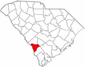
ALLENDALE COUNTY SC Cemetery GPS Mapping Project
|
Paul Kankula ( NN8NN )
Webmaster |
|
Gary Flynn ( KE8FD )
GPS Mapping |
ALLENDALE COUNTY SC Cemetery GPS Mapping Project
|
Paul Kankula ( NN8NN )
Webmaster |
|
Effective: 05/07/23 16:16 by: PMK |
USGS GEOGRAPHIC NAMES INFORMATION SYSTEM (GNIS) - POPULATED PLACES
https://geonames.usgs.gov/domestic/index.html
GOOGLE MAPS
It's very common for a cemetery to be known by several different names..!
If known, alternate names will be noted somewhere on the county's webpage listing.
Contact Gary Flynn at garyflynn44@yahoo.com, if all you know, is your cemetery's general area.
Cemetery names will normally be listed in alphabetical order. Ex: Brown-Jones-Wilson Families
Surnames will normally come before given names. Ex: Brown Family, John
Plantation names were not ordinarily shown on the Census. Using plantation names to locate ancestors can be difficult because the name of a plantation may have been changed through the years and because the sizeable number of large farms must have resulted in lots of duplication of plantation names.
Plantation nicknames names, if known, will normally be listed as aka (also known as).
It's assumed that if a plantation had over 100 enslaved workers, that there would have normally been a separate cemetery for them. Often landowner's family graves might be located nearby, but always kept separate.
Plantation homes were often burned after slave emancipation, because the landowner could no longer afford to pay their land taxes.
Historical home locations can normally be determined by locating their existing foundations.
|
Aiken-Barnwell Genealogical Society Cemetery Survey Book Surname Indexes Submitted by: Cynthia Hardy
The following Surname Indexes WILL NOT provide you with an Individual's Date-of-Birth/Death. It will only tell you in what Cemetery Survey Book, your Surname can be found in and on what page number.
Book 1 = Allendale (3), Bamberg (2) & Barnwell (18) County Cemeteries, Vol. 1, 1999
Book 2 = Allendale (11), Bamberg (9) & Barnwell (42) County Cemeteries, Vol. 2, 1999
Book 3 = Allendale (16 ), Bamberg (25) & Barnwell (93) County Cemeteries, Vol. 3, 2007
|
|
Book 1 |
|
||
|
Book 2 |
|
||
|
Book 3 |
|
|
Family History Library - Books The Church of Jesus Christ of Latter-Day Saints
|
Research Notes:
Allendale County and its county seat of Allendale were named for the Allen family, one of whose members, Paul Allen, was the town's first postmaster. The county is South Carolina's youngest; it was formed in 1919 from parts of Barnwell and Hampton counties. The area was settled in the mid-eighteenth century by English, German, and Scotch-Irish farmers, and it remains primarily agricultural. The plantation of Confederate general Johnson Hagood (1829-1898) was in what is now Allendale County, and the artist Jasper Johns spent his childhood years in Allendale. (Submitted by: SC State Library / Mary Morgan, 31-Mar-2008)
(1) & (3) =
Some F-a-G cemetery name submittals only represent a plot (gathering) of family graves -- that's located within another cemetery!
Some F-a-G church name submittals only represent a church's building location -- that doesn't have an adjoining cemetery!
Some posted F-a-G GPS locations are very inaccurate and will rarely ever get corrected by its submitter!
(2) = Text File used for miscellaneous information.
(3) = Allendale County Find-a-Grave Project
(4) = Survey Book Code # = County # - Survey Book # - Page #
AME = African Methodist Episcopal (N) SMC = Southern Methodist Church UMC = United Methodist Church ME = Methodist Episcopal
Zion AME = Zion African Methodist Episcopal (N) CME = Christian Methodist Episcopal (N) = Negro (S) = Slave (C) = Caucasian (I) = Indian (A) = Asian
|
Ref # |
Cemetery Name (1) |
GPS Mapping |
Aerial View |
Road Map |
Photos |
Text (2) |
Find a Grave (3) |
Survey Book # (4) |
Location |
|
|
|
|
|
|
|
|
|
||
|
03-001 |
Allen Chapel |
n33 00.633 , w81 15.650 |
|
|
|
|
|||
|
03-002 |
Allen Family |
can't locate cemetery |
|
|
|
03-B03-P001 |
|
||
|
03-003 |
Antioch Church |
n32 56.867 , w81 24.867 |
|
|
03-B01-P005 |
|
|||
| Appleton #1 |
can't locate cemetery |
03-B03-P001 | |||||||
| Appleton #2 |
can't locate cemetery |
03-B03-P001 | |||||||
| Barker |
can't locate cemetery |
03-B03-P004 | |||||||
|
03-004 |
Beautiful Gate Church |
n33 00.267 , w81 23.200 |
|
|
|
|
|||
|
03-005 |
Beech Branch |
n32 51.450 , w81 16.617 |
|
|
|
|
|||
|
03-006 |
Bentley Branch Baptist |
n33 06.550 , w81 24.100 |
|
|
03-B01-P024 |
|
|||
|
03-007 |
Bethel |
can't locate cemetery |
|
|
|
|
|
could be Unknown #16 |
|
|
03-008 |
Beulah Church |
n33 04.467 , w81 25.517 |
|
|
|
|
|||
| Black-Robinson |
n33 04.467 , w81 25.517 |
03-B02-P003 03-B02-P102 |
|||||||
|
03-009 |
Boyles-Brown |
can't locate cemetery |
|
|
|
|
03-B03-P010 |
|
|
|
03-010 |
Brown Family #1 |
N32 54.300 , W81 24.533 |
|
|
|
|
|||
|
03-011 |
Brown Family #2 |
n32 56.417 , w81 24.050 |
|
|
|
|
|||
|
03-012 |
Brunson Family |
n32 59.480 , w81 15.845 |
|
|
|
|
|||
|
Brunson-Morris Family |
n33 03.463 , w81 16.700 |
|
|
|
|
03-B03-009 |
|
||
|
03-013 |
Bryan-Forrester Family |
can't locate cemetery |
|
|
|
|
|
|
|
|
03-014 |
Cave UMC MethodistChurch |
n33 05.583 , w81 20.067 |
|
|
03-B02-P078 |
|
|||
|
03-015 |
Cohen Family |
n32 54.083 , w81 23.700 |
|
|
|
|
|||
|
03-016 |
Concord Baptist |
n32 59.467 , w81 25.267 |
|
|
03-B02-P001 |
Historical |
|||
|
03-017 |
Cone-Mixon Family |
can't locate cemetery |
|
|
|
|
|
|
|
| Cope |
can't locate cemetery |
03-B03-P013 | |||||||
| Crosby |
can't locate cemetery |
03-B03-P011 | |||||||
|
03-018 |
Cypress Chapel |
can't locate cemetery |
|
|
|
|
|
Relocated |
|
|
03-019 |
Doe Pond Church |
n33 02.417 , w81 26.083 |
|
|
|
|
|||
| Duncan |
can't locate cemetery |
03-B03P015 | |||||||
|
03-020 |
Ebenezer Church |
can't locate cemetery |
|
|
|
|
|
Relocated |
|
|
03-021 |
Erwinton Church |
n32 58.467 , w81 25.083 |
|
|
|
|
|||
|
03-022 |
Fairfax |
can't locate cemetery |
|
|
|
|
|
|
|
|
03-023 |
Flowers Family |
n32 55.017 , w81 23.617 |
|
|
|
|
|||
|
03-024 |
Folger Family |
n32 54.633 , w81 23.550 |
|
|
|
|
|||
|
03-074 |
Fowke Memorial |
n33 07.330 , w81 25.240 |
|
|
03-B03-P024 |
100' E of River Rd, S of Cedar Hall Rd, Martin |
|||
|
03-025 |
Furse Family |
n33 05.917 , w81 31.300 |
|
|
|
Lower 3 runs |
|||
|
03-026 |
Garvin Family #1 |
n32 53.350 , w81 25.567 |
|
|
|
aka Garbin |
|||
|
03-027 |
Garvin Family #2 |
n32 54.100 , w81 24.167 |
|
|
|
aka Garbin |
|||
|
03-028 |
Gifford-Wooten Family |
|
|
|
|
|
|
Between Fairfax and Estill, on private land |
|
|
03-029 |
Gillette Church |
n32 51.000 , w81 23.250 |
|
|
03-B02-P004 ? |
Methodist ? |
|||
|
03-030 |
Gillette Church |
n33 01.700 , w81 25.467 |
|
|
03-B02-P004 ? |
Methodist ? |
|||
|
03-031 |
Googe Family |
n32 57.682 , w81 12.472 |
|
|
|
could be Unknown #9 |
|||
|
03-032 |
Great Salkehatchie Church |
can't locate cemetery |
|
|
|
|
|
|
|
| Harley |
can't locate cemetery |
03-B03-037 | |||||||
|
03-033 |
Harmony |
can't locate cemetery |
|
|
|
|
|
aka Mixon-Cone could be Unknown #11 |
|
|
03-034 |
Harter Family |
n33 03.133 , w81 08.100 |
|
|
|
|
|||
|
03-035 |
Hayes Family |
n32 59.640 , w81 16.740 |
|
|
03-B03-P037 |
|
|||
| Hewlett |
can't locate cemetery |
03-B03-P035 | |||||||
|
03-036 |
Jackson Family, Hugh |
can't locate cemetery |
|
|
|
|
|
could be Unknown #10 |
|
|
03-037 |
Kinard Family |
can't locate cemetery |
|
|
|
|
|
could be Unknown #18 |
|
| Loadholt |
can't locate cemetery |
03-B03-P035 | |||||||
|
03-038 |
Lower Three Runs Baptist |
can't locate cemetery |
|
|
|
|
03-B02-P029 |
aka Furse |
|
|
03-039 |
Magdalene Church |
n32 55.500 , w81 25.517 |
|
|
|
|
|||
|
03-040 |
Middleton |
can't locate cemetery |
|
|
|
|
|
could be Unknown #15 |
|
|
03-041 |
Miller Creek Church |
n33 01.733 , w81 12.067 |
|
|
|
|
|||
|
03-042 |
Mount Arnon Baptist |
n33 03.800 , w81 19.217 |
|
|
03-B02-P032 |
|
|||
|
03-043 |
Mount Calvary Church |
n33 05.383 , w81 14.300 |
|
|
|
|
|||
|
03-044 |
Mount Hope Church |
n33 04.667 , w81 28.767 |
|
|
|
|
|||
|
03-045 |
Mount Pleasant Church |
n33 00.483 , w81 12.717 |
|
|
|
|
|||
|
03-046 |
Mount Saini Church |
n33 07.450 , w81 27.817 |
|
|
|
|
|||
| Myrick |
can't locate cemetery |
03-B02-P040 | |||||||
|
03-047 |
New Home |
n32 58.400 , w81 18.217 |
|
|
|
Historical |
|||
|
03-048 |
New Hope Church |
n33 04.033 , w81 16.933 |
|
|
|
|
|||
|
03-049 |
New Zion Church |
n33 02.017 , w81 18.867 |
|
|
|
|
|||
|
03-050 |
Pleasant Mountain Baptist |
n33 08.550 , w81 29.600 |
|
|
03-B02-P081
03-B03-P050 |
|
|||
|
03-051 |
Robison-Black |
can't locate cemetery |
|
|
|
|
|
|
|
|
03-052 |
Runs Baptist |
can't locate cemetery |
|
|
|
|
|
|
|
|
03-053 |
Saint James Church |
n32 51.133 , w81 21.067 |
|
|
|
|
|||
|
03-054 |
Saint James Church |
n32 57.050 , w81 17.483 |
|
|
|
|
|||
|
03-055 |
Saint Marks Church |
n32 57.517 , w81 21.233 |
|
|
|
|
|||
|
03-056 |
Saint Nicholas Lutheran |
n33 01.267 , w81 07.733 |
|
|
|
|
|||
|
03-057 |
Saint Nicholas Lutheran (Old) |
can't locate cemetery |
|
|
|
|
|
|
|
|
03-058 |
Saint Paul's |
n32 53.367 , w81 25.750 |
|
|
|
|
|||
|
03-059 |
Salkehatchie Family |
n33 06.083 , w81 11.650 |
|
|
|
|
|||
|
03-060 |
Second Calvary |
n33 02.317 , w81 16.633 |
|
|
|
|
|||
|
03-061 |
Smart Family |
n32 55.633 , w81 22.117 |
|
|
03-B02-P123 |
aka Humphreys |
|||
|
Smithfield |
n32 54.940 , w81 18.810 |
|
|
|
|
||||
|
03-062 |
Smyrna Baptist (old) |
can't locate cemetery |
|
|
|
|
03-B02-P091 ? |
|
|
|
03-063 |
Smyrna Baptist (new) |
n32 56.200 , w81 21.083 |
|
|
03-B02-P091 ? |
|
|||
|
03-064 |
Speedwell UMC Methodist |
n33 05.050 , w81 32.500 |
|
|
03-B02-P094 |
|
|||
|
03-065 |
Striker Family |
n32 53.900 , w81 24.050 |
|
|
|
|
|||
|
Stillwood Plantation |
n32 53.967 , w81 18.653 |
|
|
|
|||||
|
03-066 |
Stumpy Pond Church |
n32 59 967 , w81 09.233 |
|
|
|
|
|||
|
03-067 |
Swallow Savanna |
n32 59.583 , w81 19.450 |
|
|
|
|
|||
|
03-068 |
Trinty Church |
n32 52.450 , w81 24.333 |
|
|
|
|
|||
|
03-069 |
Union Methodist |
n32 50.433 , w81 16.983 |
|
|
|
Historical |
|||
|
03-070 |
Unknown #01 |
n34 47.770 , w81 19.292 |
|
|
|
|
|||
|
03-071 |
Unknown #02 |
n32 49.490 , w81 19.990 |
|
|
|
|
|||
|
03-075 |
Unknown #06 |
n32 56.440 , w81 23.180 |
|
|
|
|
|||
|
03-076 |
Unknown #07 |
n32 57.310 , w81 20.250 |
|
|
|
|
|||
|
03-077 |
Unknown #08 |
n32 58.020 , w81 14.290 |
|
|
|
|
|||
|
03-078 |
Unknown #09 |
n32 57.670 , w81 12.490 |
|
|
|
could be Southern Googe |
|||
|
03-079 |
Unknown #10 |
n32 58.600 , w81 10.567 |
|
|
|
could be Hughes-Jackson Branch |
|||
|
03-080 |
Unknown #11 |
n33 00.110 , w81 10.000 |
|
|
|
could be Harmony-aka Mixon-Cone |
|||
|
03-081 |
Unknown #12 |
n32 59.880 , w81 19.390 |
|
|
|
|
|||
|
03-082 |
Unknown #13 |
n33 00.830 , w81 07.370 |
|
|
|
|
|||
|
03-083 |
Unknown #14 |
n33 01.330 , w81 18.730 |
|
|
|
|
|||
|
03-084 |
Unknown #15 |
n33 01.890 , w81 21.020 |
|
|
|
could be Middleton |
|||
|
03-085 |
Unknown #16 |
n33 02.330 , w81 09.220 |
|
|
|
could be Bethel |
|||
|
03-086 |
Unknown #17 |
n33 02.110 , w81 13.560 |
|
|
|
|
|||
|
03-087 |
Unknown #18 |
n33 03.280 , w81 10.670 |
|
|
|
could be Kinard |
|||
|
03-088 |
Unknown #19 |
n33 03.140 , w81 10.130 |
|
|
|
|
|||
|
03-089 |
Unknown #20 |
n33 03.990 , w81 28.500 |
|
|
|
could be White |
|||
|
03-090 |
Unknown #21 |
n33 04.810 , w81 28.270 |
|
|
|
|
|||
|
03-091 |
Unknown #22 |
n33 07.330 , w81 25.240 |
|
|
|
|
|||
|
03-092 |
Weathersbee |
can't locate cemetery |
|
|
|
|
|
Relocated |
|
|
03-093 |
White |
can't locate cemetery |
|
|
|
|
|
could be Unknown #20 |
|
|
|
|
|
|
|
|
|
|