|
Gary Flynn ( KE8FD )
GPS Mapping |
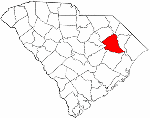
FLORENCE COUNTY SC Cemetery GPS Mapping Project
|
Paul Kankula ( NN8NN )
Webmaster |
|
Gary Flynn ( KE8FD )
GPS Mapping |
FLORENCE COUNTY SC Cemetery GPS Mapping Project
|
Paul Kankula ( NN8NN )
Webmaster |
|
Effective: 07/27/20 15:39 by: PMK |
USGS GEOGRAPHIC NAMES INFORMATION SYSTEM (GNIS) - POPULATED PLACES
https://geonames.usgs.gov/domestic/index.html
GOOGLE MAPS
It's very common for a cemetery to be known by several different names..!
If known, alternate names will be noted somewhere on the county's webpage listing.
Contact Gary Flynn at garyflynn44@yahoo.com, if all you know, is your cemetery's general area.
Cemetery names will normally be listed in alphabetical order. Ex: Brown-Jones-Wilson Families
Surnames will normally come before given names. Ex: Brown Family, John
Plantation names were not ordinarily shown on the Census. Using plantation names to locate ancestors can be difficult because the name of a plantation may have been changed through the years and because the sizeable number of large farms must have resulted in lots of duplication of plantation names.
Plantation nicknames names, if known, will normally be listed as aka (also known as).
It's assumed that if a plantation had over 100 enslaved workers, that there would have normally been a separate cemetery for them. Often landowner's family graves might be located nearby, but always kept separate.
Plantation homes were often burned after slave emancipation, because the landowner could no longer afford to pay their land taxes.
Historical home locations can normally be determined by locating their existing foundations.
|
Three-Rivers Historical Society (Serving: Williamsburg, Florence, Marion, Georgetown, Sumter, Darlington, and Horry Counties)
Cemetery Survey Book Surnames Submitted by: Kathy Loyd
The following Surname Indexes WILL NOT provide you with an Individual's Date-of-Birth/Death. It will only tell you in what Cemetery Survey Book, your Surname can be found in and on what page number.
Book 1 = Florence County vol. 1, (22) cemeteries, Johnsonville-Hemingway Area/Old Williamsburg District, by: Elaine Y. Eaddy, burials before 1979, 193 pgs
Book 2 = Florence County, vol. 2, (30) cemeteries, Eern Section Lower Florence County, by: Elaine Y. Eaddy, burials before 1979, 160 pgs
Book 3 = ?
Book 4 = Florence County, vol. 3, (26) cemeteries, Lower Florence County, by: Elaine Y. Eaddy, burials before 1979, 143 pgs Book 5 = Florence County, vol. 4, (22) cemeteries, by: Elaine Y. Eaddy, burials before 1979, 126 pgs
Book 6 = Florence National Cemetery, 21-074, by: Jason R. Cockfield, burials before 1996, 225 pgs
Book 7 = Florence-Clarendon-Williamsburg Counties, (65) cemeteries, by: Bernice G. McCutcheon, burials before 1992, 275 pgs
Book 8 = Sermons in Stones, vol. 1, Florence-Georgetown- Williamsburg counties, (25) cemeteries, by: Jason R. Cockfield, burials before 1994, ~300 pgs
Book 9 = Sermons in Stones, vol. 2, (75) cemeteries, S of the Lynches River, by: Jason R. Cockfield, burials before 1998, 514 pgs
Book 10 = Sermons in Stones, vol. 3, (36) cemeteries, Eern Florence County, by: Jason R. Cockfield, 323 pgs
Book 11 = Mount Hope Cemetery & Mausoleum, 21-161, Florence, by: Connie M. Post, burials before 1993, 183 pgs
Book 12 = Florence-Georgetown-Williamsburg Counties, (25) cemeteries, by: Jason R. Cockfield,burials before 1994
|
|
Book 1 |
|
|
|||
|
Book 2 |
|
|
|
||
|
Book 3 |
|||||
|
Book 4 |
|
|
|||
|
Book 5 |
|
|
|
|
|
|
Book 6 |
|
|
|
||
|
Book 7 |
|
||||
|
Book 8 |
|||||
|
Book 9 |
|||||
|
Book 10 |
|
||||
|
Book 11 |
|||||
|
Book 12 |
|
|
Family History Library - Books The Church of Jesus Christ of Latter-Day Saints
|
Research Notes:
Florence County took its name from its county seat, the city of Florence. The county was formed in 1888 from parts of Marion, Darlington, Williamsburg, and Clarendon counties. The city of Florence was founded in the 1850s as a stop on the Wilmington and Manchester Railroad; it was named for Florence Harllee, daughter of William Wallace Harllee (1812-1897), the president of the railroad. Florence soon became an important transportation center for the Pee Dee region. During the Civil War it was the site of a Confederate prison camp. In later years tobacco growing became a major activity in the county. Some famous Florence County natives are artist William H. Johnson (1901-1970), astronaut Ronald E. McNair (1950-1986), and stock car racer Cale Yarborough. (Submitted by: SC State Library / Mary Morgan, 31-Mar-2008)
(1) = Florence County Find-a-Grave Project
(2) = Survey Book Code # = County # - Survey Book # - Page #
AME = African Methodist Episcopal (N) SMC = Southern Methodist Church UMC = United Methodist Church ME = Methodist Episcopal
Zion AME = Zion African Methodist Episcopal (N) CME = Christian Methodist Episcopal (N) = Negro (S) = Slave (C) = Caucasian (I) = Indian (A) = Asian
E-Mail: kankula@bellsouth.net TO REPORT BROKEN LINKS
|
Ref # |
Cemetery Name |
GPS Mapping |
Aerial View |
Road Map |
Photos |
Text |
Find a Grave (1) |
Survey Book (2) |
Location |
|
|
|
|
|
|
|
|
|
|
|
|
21-001 |
Aimwell |
n33 56.475 , w79 29.885 |
aka McWhite
w of Old River Rd & McWhite Circle, Pamplico\ |
||||||
|
21-002 |
Aimwell Baptist |
n33 56.949 , w79 33.227 |
e of Bass Rd, w of SR 51, Pamplico |
||||||
|
21-003 |
Allison |
n33 52.733 , w79 24.133 |
end of Ports Ferry Rd, e of Powells Corner Rd, Johnsonville |
||||||
|
21-004 |
Anderson Family |
n34 05.204 , w79 52.723 |
Turnstone Rd, w of Langston Rs, Timmonsville |
||||||
|
21-005 |
Anderson Family |
n34 03.165 , w79 51.500 |
1800 ft w of Langston Rd, .8 miles s of Alvin Kirby Rd, Timmonsville |
||||||
|
21-006 |
Anderson Family |
n34 10.867 , w79 55.165 |
600 ft n of Holly Brush Rd. 100 ft e of County Line,Timmonsville |
||||||
|
21-007 |
Anderson Family |
n34 00.278 , w79 44.215 |
n of Harvast Rd, w of Othello Rd, Coward |
||||||
|
21-008 |
Askins, Taylor |
Can't locate cemetery |
|
|
|
||||
|
21-009 |
Back Swamp (unidentified) (N) |
Can't locate cemetery |
|
|
|
||||
|
21-010 |
Baxley |
n33 49.950 , w79 32.483 |
SR 341 & Baxley Rd, Johnsonville |
||||||
|
21-011 |
Bay Branch Cemetery (N) |
n34 06.813 , w79 58.813 |
100 ft n of US 76, 100 w of Iveydale Rd, Timmonsville |
||||||
|
21-012 |
Bay Branch Freewill Baptist |
n34 06.744 , w79 58.800 |
US 76 & Iveydale Rd, Timmonsville |
||||||
|
21-013 |
Bazen |
n33 52.700 , w79 33.646 |
w of Hoyt Rd, s of US 378, Pamplico |
||||||
|
21-014 |
Beaverdam |
n33 54.350 , w79 40.330 |
Beaverdam Cemetery Rd, 500 ft w of Old Georgetown Rd, Scranton |
||||||
|
21-015 |
Bethany |
n33 59.683 , w79 52.917 |
w of US 301, s of Creek Rd, Timmonsville |
||||||
|
21-016 |
Bethel Apostolic |
n34 12.800 , w79 45.820 |
behind Old Wilso School, N. Irby St, Florence |
||||||
|
21-017 |
Bethel Baptist |
n33 58.767 , w79 54.183 |
US 301, e of SR 403, Scranton |
||||||
|
21-018 |
Bethel Free Will Baptist |
n34 09.135 , w79 35.152 |
s of Bethel Rd, e of Mercedes Way, Florence |
||||||
|
21-019 |
Beulah Free Will Baptist |
n33 54.675 , w79 32.125 |
n of Bazen Rd, w of SR 51, Pamplico |
||||||
|
21-020 |
Beulah Free Will Baptist |
n33 58.650 , w79 49.950 |
Old Number Four Hwy & Farm Rd, Scranton |
||||||
|
21-021 |
Beulah Baptist |
n33 59.753 , w79 35.520 |
SR 51, e of Big Swamp Rd, Pamplico |
||||||
|
21-022 |
Bible Temple |
n34 58.910 , w79 44.645 |
Gause Canal Rd & St Paul Rd, Coward |
||||||
|
21-023 |
Blackwell-Burch |
n34 09.100 , w79 43.495 |
300 ft west of 2137 Waverly Woods, Florence |
||||||
|
21-024 |
Blooming Grove Plantation |
n34 15.917 , w79 42.707 |
E. Campground Rd, at Florence RV Park, Florence |
||||||
|
21-025 |
Briley Ham Family |
Can't locate cemetery |
|
|
|
||||
|
21-026 |
Britt Family |
Can't locate cemetery |
|
|
|
||||
|
21-027 |
Brockinton Family |
Can't locate cemetery |
|
|
|
||||
|
21-028 |
Brown |
n34 49.328 , w79 38.161 |
100 ft w of Old Georgetown Rd, 500 ft s of Browntown Cem. Rd, Lake City |
||||||
|
21-029 |
Brown |
n33 49.517 , w79 38.000 |
aka Browntown
Browntown Cemetery Rd, 1000 ft e of Georgetown Rd, Lake City |
||||||
|
21-030 |
Browns Chapel UMC Methodist |
n33 49.883 , w79 37.850 |
SR 341 & N C C Rd, Lake City |
||||||
|
21-031 |
Bryan |
n33 59.743 , w79 31.699 |
w of Old River Rd, n of River Rd, Pamplico |
||||||
|
21-032 |
Byrd |
n34 07.667 , w79 57.133 |
s of W Main St, n of Layton Dr, Timmonsville |
||||||
|
21-033 |
Byrd |
n33 57.207 , w79 51.600 |
Shady Ln, 800 ft e of SR 403, Scranton |
||||||
|
21-034 |
Cameron |
n33 51.769 , w79 43.679 |
e of Cemetery Rd, ne of E. Main St, Lake City |
||||||
|
21-035 |
Camp Branch Free Will Baptist |
n33 54.533 , w79 49.017 |
Bethel Rd & Glendale School Rd, Scranton |
||||||
|
21-036 |
Camp Branch Pentecostal Holiness |
n33 54.465 , w79 48.870 |
Bethel Rd, w of Camp Branch Rd, Scranton |
||||||
|
21-037 |
Campbell Plantation |
n34 05.126 , w79 36.757 |
2000 ft n of Springbranch Rd, .5 miles e of Silver Fox Rd, Effingham |
||||||
|
21-038 |
Carraway |
Can't locate cemetery |
|
|
Near Coward |
||||
|
21-039 |
Carter |
n33 51.900 , w79 36.500 |
Creek Rd, w of Jeff Landing Rd, Lake City |
||||||
|
21-040 |
Carters |
n34 04.129 , w79 45.917 |
Graveyard Rd, 1000 ft w of US 301, Effingham |
||||||
|
21-041 |
Cartersville Baptist |
n34 04.864 , w80 01.765 |
Rd 21-127, 1200 ft e of US 76, Timmonsville |
||||||
|
21-042 |
Casselman |
n33 53.240 , w79 47.080 |
end of Peace Rd, n of W Main St, Lake City |
||||||
|
21-043 |
Central Baptist |
n34 16.400 , w79 42.590 |
Pocket Rd, w of Williston Rd, Florence |
||||||
|
21-044 |
Central UMC Methodist Columbarium |
n34 11.750 , w79 45.101 |
225 E Cheves St, Florence |
||||||
|
21-045 |
Chaney Grove Baptist |
n34 05.667 , w79 59.100 |
Chaney Grove Rd & Joe Nathan Ln, Timmonsville |
||||||
|
21-046 |
China Grove |
n34 05.424 , w79 59.220 |
Chaney Grove Rd & Pine Hurst Rd, Timmonsville |
||||||
|
21-047 |
Christ Assembly |
Can't locate cemetery |
|
|
|
||||
|
21-048 |
Christ Episcopal |
n34 14.600 , w79 41.517 |
w of SR 327, n of Old Marion Hwy, Florence |
||||||
|
21-049 |
Christian Fellowship |
n34 01.030 , w79 41.730 |
w of Friendfield Rd, n of Rushtown Rd, Effingham |
||||||
|
21-050 |
Church of Christ |
n34 09.121 , w79 53.004 |
s of Palmetto St, e of Litchfield Rd, Florence |
||||||
|
21-052 |
Church of God of the Firstborn |
n34 21.178 , w79 56.878 |
500 ft w of SR 403, .25 miles s of Cartersville Hwy, Timmonsville |
||||||
| Civil War Era National Cemetery | 34.184719 , -79.754224 | A | M | Florence | |||||
|
21-053 |
Clark (N) |
Can't locate cemetery |
|
|
|
||||
|
21-054 |
Cockfield |
n33 53.310 , w79 40.295 |
e of Old Georgetown Rd, n of Marvin Rd, Lake City |
||||||
|
21-055 |
Cockfield Landing |
n33 57.217 , w79 41.320 |
1100 ft e of Anderson Bridge Rd & Lockhard Rd, Coward |
||||||
|
21-056 |
Cockfield-Lynch |
n33 58.901 , w79 48.238 |
1200 ft e of McAllister Rd, 1000 ft n of Wylie Rd, Coward |
||||||
|
21-057 |
Collins |
n34 05.031 , w79 48.201 |
1300 ft n of McLaughlin Rd, 2500 ft e of Stagecoach Rd, Effingham |
||||||
|
21-058 |
Cook |
n33 52.100 , w79 48.500 |
end of Memory Ln, n of Morris St, Lake City |
||||||
|
21-059 |
Cook |
n33 49.205 , w79 34.360 |
100 ft w of Hanna Lake Rd & Cook Ln, Johnsonville |
||||||
|
21-060 |
Coward |
n34 01.082 , w79 43.082 |
n of Catfish Rd, e of Old Georgetown Rd, Coward |
||||||
|
21-061 |
Coward Pentecostal Holiness |
n33 58.120 , w79 44.660 |
of Friendship Rd, e of US 52, Coward Unk #23 |
||||||
|
21-062 |
Cox |
Can't locate cemetery |
|
|
Pamplico |
||||
|
21-063 |
Creel |
Can't locate cemetery |
|
|
Hannah |
||||
|
21-064 |
Crosby |
n33 53.220 , w79 47.250 |
Peace Rd, 200 ft n of Main St, Lake City |
||||||
|
21-065 |
Cumberland UMC Methodist |
n34 11.081 , w79 45.706 |
National Cemetery Rd & Church St, Florence |
||||||
|
21-066 |
Cusaac Cemetery (N) |
n34 00.250 , w79 48.833 |
600 ft s of Oak Grove Rd, 500 ft w of Meadow Prong Rd, Effingham |
||||||
|
21-067 |
Daniels Family |
Can't locate cemetery |
|
|
|
||||
|
21-068 |
Davis Family (N) |
Can't locate cemetery |
|
|
|
||||
|
21-069 |
Dawson |
n33 59.611 , w79 48.863 |
1000 ft n ofOld Number 4 Hwy, 1000 ft w of McAllister Mill Rd,Scranton |
||||||
|
21-070 |
DeWitt Family |
Can't locate cemetery |
|
|
|
||||
|
21-071 |
Eaddy |
n33 49.400 , w79 31.250 |
n of SR 341, e of Eaddy Ford Rd, Johnsonville |
||||||
|
21-072 |
Eaddy-Ford |
n33 48.417 , w79 30.983 |
w of Eaddy Ford Rd, .6 miles n of Vox Hwy, Johnsonville |
||||||
|
21-073 |
Eaddy-Ford |
n33 48.532 , w79 31.140 |
w of Eaddy Ford Rd, .9 miles n of Vox Hwy, Johnsonville |
||||||
|
21-074 |
Ebenezer Baptist |
n34 10.733 , w79 51.100 |
Ebenezer Rd, n of Pine Needles Rd, Florence |
||||||
|
21-075 |
Effingham |
n34 03.372 , w79 45.320 |
e of US 52, .7 miles s of US 301,Effingham |
||||||
|
21-076 |
Elim Baptist |
n34 02.907 , w79 47.948 |
Stagecoach Rd, n of US 301, Elim |
||||||
|
21-077 |
Elim Bible |
n34 02.752 , w79 47.907 |
500 ft s of US 301 , w of Stagecoach Rd, Elim |
||||||
|
21-078 |
Elizabeth Baptist |
n34 06.917 , w79 42.650 |
SR 51 & Cato Rd, Florence |
||||||
|
21-079 |
Elmor |
n34 00.646 , w79 46.401 |
1100 ft w of Johnnie Lee Rd, 600 ft n o New Hope Rd, Coward fUnk #28 |
||||||
|
21-080 |
Ephesus Church |
n33 54.817 , w79 28.017 |
100 ft e of River Rd, 1500 ft s of Chinaberry Rd, Johnsville |
||||||
|
21-081 |
Evans |
n33 59.350 , w79 47.590 |
50 ft n of Lynch Rd, just e of York Ln, Coward Unk #25 |
||||||
|
21-082 |
Evans |
n33 52.012 , w79 30.695 |
Evans Rd, n of Mill House Rd, Johnsville |
||||||
|
21-083 |
Evans (grave) |
n33 53.718 , w79 30.295 |
500 ft n of St Luke Church Rd, 500 ft w of Wingo Rd, Pamplico |
||||||
|
21-084 |
Evergreen Baptist |
n34 04.117 , w79 40.783 |
Lebanon Rd & Pamplico Hwy, Effingham |
||||||
|
21-085 |
Florence Memorial Gardens |
n34 09.800 , w79 50.533 |
Cashua Dr & Old Ebenezer Rd, Florence |
||||||
|
21-086 |
Florence National Cemetery |
n34 11.040 , w79 45.300 |
National Cemetery Rd & Gaillard Rd, Florence |
||||||
|
21-087 |
Florence Presbyterian |
Can't locate cemetery |
|
|
|
||||
|
21-088 |
Flowers-Timmons-Field |
n33 57.720 , w79 41.938 |
2000 ft n of Lockwood Rd, 800 ft w of Old Georgetown Rd, Scranton |
||||||
|
21-089 |
Floyd |
Can't locate cemetery |
|
|
|
||||
|
21-090 |
Fraternity |
n34 11.600 , w79 44.833 |
Levy Park, Florence |
||||||
|
21-091 |
Friendfield Pentecostal Holiness |
n33 56.421 , w79 39.449 |
Friendship Rd, s of Rogers Ln, Scranton |
||||||
|
21-092 |
Friendship Methodist |
n34 13.194 , w79 38.010 |
Old Marion Hwy, w of Firetower Rd, Florence |
||||||
|
21-093 |
Fryer-Keeffe |
n34 00.565 , w79 31.950 |
700 ft w of Old River Rd, .6 miles s of Keeffe Rd, Pamplico |
||||||
|
21-094 |
Garden of Devotion |
n33 47.567 , w79 26.600 |
SR 41, s of Willow Pond Rd, Johnsonville |
||||||
|
21-095 |
Garden of Memories |
n34 05.967 , w79 42.033 |
Pamplico Hwy, Amanda Circle, Florence |
||||||
|
21-096 |
Gaskin, E.V. |
n33 49.800 , w79 40.367 |
1000 ft e of Cameron Rd & Preston Rd, Lake City |
||||||
|
21-097 |
Gaskins |
n33 51.517 , w79 36.900 |
500 ft w of Fennell Rd, n of Huggins Rd, Lake City |
||||||
|
21-098 |
Gaskins |
n33 52.067 , w79 34.550 |
n of Cain Branch Circle, e of Gaskins Ln, Pamplico |
||||||
|
21-099 |
Gaskins |
n33 48.890 , w79 41.765 |
aka Lynch
end of Gaskins Rd, w of Indiantown Rd, Lake City |
||||||
|
21-100 |
Gause |
n33 59.400 , w79 42.517 |
Cause Canal Rd, e of New Coward Rd, Coward |
||||||
|
21-101 |
Gause |
n34 02.800 , w79 45.940 |
e of Ben Cause Rd, e of River Bank Rd, Coward Unk #30 |
||||||
|
21-102 |
Gee, John |
Can't locate cemetery |
|
|
|
||||
|
21-103 |
Gee, William |
Can't locate cemetery |
|
|
|
||||
|
21-104 |
Godwin |
n33 52.978 , w79 44.872 |
aka Kelly
Railroad Ave, s of McCutcheon Rd, Lake City |
||||||
|
21-105 |
Godwin |
n33 52.944 , w79 44.119 |
200 ft w of Zola Rd, 400 ft n of McCutcheon Rd, Lake City |
||||||
|
21-106 |
Graham |
n33 54.491 , w79 45.700 |
w of Wilmer Rd,off Cleveland Rd, .6 miles s of Camp Branch Rd, Scranton Unk #11 |
||||||
|
21-107 |
Gray |
n33 51.463 , w79 48.412 |
750 ft e of Gray Rd, . 5 miles s of Morris St, Lake City |
||||||
|
21-108 |
Greater Saint Paul AME Methodist (N) |
n34 05.900 , w79 38.317 |
Francis Marion Rd, s of Four Seasons Rd, Florence |
||||||
|
21-109 |
Greater Saint Paul Methodist |
n33 48.485 , w79 35.845 |
Bert Hanna Rd, s of Vox Hwy, Hemmingway |
||||||
|
21-110 |
Grier |
n33 49.417 , w79 27.167 |
e of Diamond Branch Rd, s of Venters Ave, Johnsonville |
||||||
|
21-111 |
Griggs Family |
Can't locate cemetery |
|
|
|
||||
|
21-112 |
Grimsley |
n34 13.367 , w79 39.550 |
e of Fore Rd, .5 miles s of Old Marion Hwy, Florence |
||||||
|
21-113 |
Hancock |
n33 54.105 , w79 50.124 |
300 ft w of Glendale School Rd, 500 ft s of Powell Rd, Scranton |
||||||
|
21-114 |
Hanna, Hugh |
n33 49.200 , w79 34.650 |
aka Garden of Memories
Hanna Cemetery Rd, w of Hanna Lake Rd, Johnsonville |
||||||
|
21-115 |
Hanna |
n33 51.100 , w79 37.740 |
Queens Ln, 600 ft n of Huggins Rd, Lake City |
||||||
|
21-116 |
Hardy- Hill |
Can't locate cemetery |
|
|
|
||||
|
21-117 |
Hebrew Benevolent Society |
n34 10.931 , w79 45.642 |
S Church St & Prout Dr, Florence |
||||||
|
21-118 |
Hebron Baptist |
n33 58.817 , w79 40.550 |
aka Friendfield
Francis Marion Rd, w of Friendship Rd, Scranton |
||||||
|
21-120 |
High Hill Free Will Baptist |
n33 54.950 , w79 41.667 |
US 378, w of Union School Rd, Scranton |
||||||
|
21-121 |
Hillside Free Will Baptist |
n34 09.660 , w79 44.390 |
Lemont Dr, w of Purvis Dr, Florence |
||||||
|
21-122 |
Hopewell Presbyterian |
n34 07.700 , w79 37.433 |
n of Old River Rd, e of SR327, Florence |
||||||
|
21-123 |
Howard Chapel Free Will Baptist |
n34 04.573, w79 55.835 |
Old Middle Rd, e of Hill Rd, Timmonsville |
||||||
|
21-124 |
Howe |
n34 08.350 , w79 44.667 |
e of Park Pl, n of Boardwalk, Florence |
||||||
|
21-125 |
Hudson |
n34 02.163 , w79 56.891 |
500 ft w of SR 403, .25 miles s of Cartersville Hwy, Timmonsville |
||||||
|
21-126 |
James |
n34 14.230 , w79 39.280 |
n of Rankin Plantation Rd, e of Corrie Farm Rd, Florence |
||||||
|
21-127 |
Johnson |
n33 50.517 , w79 28.133 |
500 ft s of Sand Pit Rd, 1.2 miles w of SR 51. Johnsonville |
||||||
|
21-128 |
Jolly-Howard |
n34 08.164 , w79 33.248 |
4000 ft e of Paper Mill Rd on Don McCain Dr, Florence Co. Land Fill |
||||||
|
21-129 |
Jones |
n33 48.983 , w79 42.317 |
1700 ft e of Jones Rd & Askins Lake, Lake City |
||||||
|
21-130 |
Jones-Huggins |
n34 01.177 , w79 50.659 |
100 ft e of US 301, 200 ft n of Rasberry Ln, Timmonsville |
||||||
|
21-131 |
Jordan Chapel |
n33 57.267 , w79 55.350 |
703 North Jones Rd, Olanta |
||||||
|
21-132 |
Jordan Family |
Can't locate cemetery |
|
|
|
||||
|
21-133 |
Jordan, London Family (N) |
Can't locate cemetery |
|
|
|
||||
|
21-134 |
Kelley-McCallister |
n33 52.780 , w45.925 |
Burch St & Opal St, Lake City |
||||||
|
21-135 |
Kennedy |
Can't locate cemetery |
|
|
|
||||
|
21-136 |
Kennedy-Howe (N) |
Can't locate cemetery |
|
|
|
||||
|
21-137 |
Lake Chapel |
n33 48.567 , w79 29.250 |
end of Lake Chapel Rd, w of Deerfield Rd, Johnsonville |
||||||
|
21-138 |
Lake City Cemetery |
n33 52.533 , w79 44.967 |
N. Church St & Valley St, Lake City |
||||||
|
21-139 |
Lake City First Baptist |
n33 52.230 , w79 45.200 |
S. Church St & Irvin St, Lake City aka Singletary or Presbyterian Cemetery |
||||||
|
21-140 |
Lake City Memorial Park |
n33 52.815 , w79 46.300 |
W. Main St & Winners Circle, Lake City |
||||||
|
21-141 |
Langston Family |
Can't locate cemetery |
|
|
|
||||
|
21-142 |
Lawhon Family |
n34 06.810 , w79 54.307 |
1400 ft n of Center Rd, .3 miles e of I-95, Timmonsville |
||||||
|
21-143 |
Lebanon Free Will Baptist |
n34 02.967 , w79 43.450 |
Lebanon Rd & Friendfield Rd, Effingham |
||||||
|
21-144 |
Lee |
n33 52.615 , w79 38.905 |
McCutcheon Rd, .4 miles w of Creek Rd, Lake City |
||||||
|
21-145 |
Lee |
n33 57.880 , w79 50.540 |
1000 ft n of Salem Rd, .5 miles e of Floyd Rd, Scranton |
||||||
|
21-146 |
Lee |
n33 58.050 , w79 49.940 |
1000 ft n of Salem Rd, 500 ft e of Pole Cat Rd, Scranton |
||||||
|
21-147 |
Lee (N) |
n33 52.660 . W79 39.125 |
n of McCutcheon Rd, behind Sandhill Cem, Lake City |
||||||
|
21-148 |
Leonard, Mullins Family (N) |
Can't locate cemetery |
|
|
|
||||
|
21-149 |
Liberty Chapel Methodist |
n34 10.550 , w79 35.517 |
Liberty Chapel Rd & National Cemetery Rd, Florence |
||||||
|
21-150 |
Little Star Free Will Baptist |
n33 50.110 , w79 35.147 |
s of SR 341, w of Forty five Rd, Lake City |
||||||
|
21-151 |
Lynch-Graham |
n33 52.123 , w79 42.445 |
1150 McCutcheon Rd, Lake City |
||||||
|
21-152 |
Lynchs Memorial Gardens |
n34 02.000 , w79 47.283 |
Ben Gause Rd & County Park Rd, Coward |
||||||
|
21-153 |
Lynches River Free Will Baptist |
n33 54.496 , w79 41.820 |
s of US 378, e of Ronald Rd, Scranton |
||||||
|
21-154 |
Macedonia Cemetery |
n34 05.533 , w80 03.167 |
A |
end of Dickfield Rd, s of Lynches River Rd, Timmonsville (Field-USGS) |
|||||
|
21-155 |
Mandeville-Rogers |
Can't locate cemetery |
|
|
|
||||
|
21-156 |
Manoah Methodist |
n33 52.070 , w79 48.860 |
A |
Cooktown Rd, s of Ronnies Ln, Lake City |
|||||
|
21-157 |
Matthews Cemetery |
n33 53.900 , w79 46.110 |
A |
Siesta Ln, 300 ft off Matthews Rd, Lake City |
|||||
|
21-158 |
Matthews Cemetery |
n33 58.709 , w79 46.473 |
A |
Sunset Rd, 200 ft s of Lynch Rd, Coward |
|||||
|
21-159 |
McCall, G.J.W. Plantation (N) |
Can't locate cemetery |
|
|
|
||||
|
21-160 |
McCown Family |
Can't locate cemetery |
|
|
|
||||
|
21-161 |
McGee-Wilkes |
n33 59.002 , w79 49.180 |
A |
w of Serenity Rd, s of Old Number 4 Hwy, Scranton |
|||||
|
21-162 |
McGees Mission of Christ |
n33 58.011 , w79 43.498 |
A |
McGee Rd, n of Friendfield, Coward |
|||||
|
21-163 |
McKenzie Cemetery |
Can't locate cemetery |
|
|
|
||||
|
21-164 |
McLaughlin |
n34 05.050 , w79 46.385 |
end of McLaughlin Cemetery Rd, w of Anderson Field Rd, Effingham |
||||||
|
21-165 |
McPherson |
n34 09.267 , w79 42.500 |
n of Wilshire Ct, e of Trilly Ln, Florence |
||||||
|
21-166 |
Meadow Prong Baptist |
n34 02.250 , w79 49.600 |
Meadow Prong Rd, n of US 301, Effingham |
||||||
|
21-167 |
Merck, Ransom (N) |
Can't locate cemetery |
|
|
|
||||
|
21-168 |
Mill Branch Baptist |
n33 51.992 , w79 30.665 |
Evans Rd, n of Mill House Rd, Johnsville |
||||||
|
21-169 |
Mill Branch |
n33 51.417 , w79 29.217 |
e of Foxbay Rd, 500 ft e of Sand pit Rd, Johnsonville |
||||||
|
21-171 |
Mill Branch AME Methodist (N) |
n34 03.600 , w79 32.733 |
Old River Rd, n of Mill Branch Rd, Pamplico |
||||||
|
21-172 |
Ministerial Union (N) |
Can't locate cemetery |
|
|
|
||||
|
21-173 |
Mizpah |
n34 14.383 , w79 41.317 |
aka Hinds
e of SR 327, n of Golden Pond Ln, Florence |
||||||
|
21-174 |
Moody |
n34 13.317 , w79 37.183 |
e of Milissa Mae Rd, n of Old Marion Hwy, Florence |
||||||
|
21-175 |
Moore |
Can't locate cemetery |
|
|
|
||||
|
21-176 |
Morris |
n34 07.369 , w79 54.303 |
2000 ft sw of Peniel Rd, 1500 ft nw of I-95, Timmonsville |
||||||
|
21-177 |
Mossy Grove |
n34 00.683 , w79 47.717 |
Mossy Grove Rd , w of Old Number 4 Hwy, Coward |
||||||
|
21-178 |
Mount Carmel Baptist |
n34 09.370 , w79 55.530 |
Mount Carmel Rd & Clearway Ln, Timmonsville |
||||||
|
21-179 |
Mount Elon Free Will Baptist |
n34 01.733 , w79 35.967 |
7 Mile Rd, n of Kennedy-Haines Rd, Pamplico (USGS-Gibbs) |
||||||
|
21-180 |
Mount Hope |
n34 10.900 , w79 45.833 |
s of Cherokee Rd, e of US 301, Florence |
||||||
|
21-181 |
Mount Tabor |
n34 03.680 , w79 38.840 |
Mt Tabor Cemetery Rd, w of Framcis Marion Rd, Effingham |
||||||
|
21-182 |
Mount Zion Baptist |
n33 57.050 , w79 33.217 |
Mt. Zion Rd SR 51, Pamplico |
||||||
|
21-183 |
Mount Zion UMC Methodist |
n34 10.770 , w79 37.793 |
n of Liberty Chapel Rd, .8 miles e of SR 327, Florence |
||||||
|
21-184 |
Mountain |
Can't locate cemetery |
|
|
|
||||
|
21-185 |
Moye, W.L. Family |
Can't locate cemetery |
|
|
|
||||
|
21-186 |
Muldrow, Hugh Family |
Can't locate cemetery |
|
|
|
||||
|
21-187 |
Muldrow, John Family |
Can't locate cemetery |
|
|
|
||||
|
21-188 |
Muldrow Mill (unidentified) (N) |
Can't locate cemetery |
|
|
|
||||
|
21-189 |
Munn |
n33 59.784 , w79 36.440 |
1500 ft n of Hyman Rd & Little Farm Rd, Pamplico |
||||||
|
21-190 |
Myers |
n34 07.580 , w79 48.140 |
Whippoorwill Rd & Myers Cemetery Rd, Effingham |
||||||
|
21-191 |
Nettles |
n34 15.020 , w79 47.830 |
e of Pisgah Rd, n of range Way, Florence |
||||||
|
21-192 |
New Hope Free Will Baptist |
n33 49.517 , w79 25.467 |
New Hope Rd, n of Possom Fork Rd, Johnsonville |
||||||
|
21-193 |
New McFadden |
n33 53.693 , w79 56.674 |
1500 ft w of Park Ave, .5 miles n of US 378, Olanta |
||||||
|
21-194 |
New Prospect Free Will Baptist |
n33 51.810 , w79 33.445 |
Sheminally Rd, w of Half Moon Rd, Pamplico |
||||||
|
21-195 |
New Zion Missionary Baptist |
n34 02.459 , w79 56.721 |
SR 403, s of Creek Rd, Timmonsville |
||||||
|
21-196 |
New Zion Baptist |
n33 55.850 , w79 48.930 |
aka Flowers
McAllister Mill Rd & Nettles Rd, Lake City |
||||||
|
21-197 |
Ninevah UMC Methodist |
n33 50.250 , w79 36.933 |
aka Leo
e of Leo Rd, n of SR 341, Lake City |
||||||
|
21-198 |
North View |
n34 12.550 , w79 45.600 |
aka North Vista
s of Vista St, e of Boyd St, Florence |
||||||
|
21-199 |
Nowlin |
n34 03.997 , w79 49.520 |
Pygatt Rd & Minus Ln, Effingham |
||||||
|
21-200 |
Olanta Baptist |
n33 55.386 , w79 56.282 |
w of Park Ave, n of McElveen Cut Rd, Olanta |
||||||
|
21-201 |
Olanta Church of God of Prophecy |
n33 55.856 , w79 55.654 |
Main St & Thomas St, Olanta |
||||||
|
21-202 |
Olanta Pentecostal Holiness |
n33 55.525 , w79 55.764 |
Central Rd, s of Rhett Rd, Olanta |
||||||
|
21-203 |
Olanta First Presbyterian |
n33 56.263 , w79 56.084 |
Main St & US 301, Olanta |
||||||
|
21-204 |
Old Johnsonville UMC Methodist |
n33 47.250 , w79 26.650 |
SR 41, n of County Line Rd, Johnsonville |
||||||
|
21-205 |
Old Landing |
n33 51.750 , w79 33.183 |
aka Ola Neck
end of Old Landing Rd, s of Sheminally Rd, Pamplico |
||||||
|
21-206 |
Old Liberty |
n33 53.850 , w79 40.033 |
e of Creek Rd, s of Lee Landing Rd, Lake City |
||||||
|
21-207 |
Old Midway Baptist |
n34 04.375 , w79 56.128 |
1000 ft ew of Hill Rd & Old Middle Rd,Timmonsville |
||||||
|
21-208 |
Olive Grove Baptist |
n34 01.267 , w79 43.283 |
1500 ft e of Old Georgetown Rd, 350 ft s of Horse House Rd, Coward |
||||||
|
21-209 |
Owens |
n33 47.152 , w79 28.399 |
250 ft e of Howells Farm Rd, n of County Line Rd, Hemmingway |
||||||
|
21-210 |
Pauper Cemetery |
Can't locate cemetery |
|
|
|
||||
|
21-211 |
Pee Dee Memorial |
n34 06.342 , w79 35.426 |
e of Old River Rd, n of willow Creek Baptist, Florence |
||||||
|
21-212 |
Peniel Baptist |
n34 06.130 , w79 52.640 |
Twin Church Rd & Peniel Rd, Timmomsville |
||||||
|
21-213 |
Pentecostal Cemetery |
n33 54.830 , w79 28.590 |
Pentecostal Cemetery Rd, , w of Chinaberry Rd, Johnsonville |
||||||
|
21-212 |
Pettigrew Family |
Can't locate cemetery |
|
|
|
||||
|
21-213 |
Pigiott Field |
n34 11.050 , w79 41.700 |
n of Large Farm Rd, w of Wallace Rd, Florence |
||||||
|
21-214 |
Pisgah UMC Methodist |
n34 12.685 , w79 50.405 |
Ebenezer Rd, n of Hoffmeyer Rd, Florence |
||||||
|
21-215 |
Player |
Can't locate cemetery |
|
|
near High Hill Baptist, Scranton |
||||
|
21-216 |
Pleasant Grove Church of God of Prophecy |
n33 59.310 , w79 49.220 |
1000 ft nw of Old Number 4 Hwy, 600 ft n of Church |
||||||
|
21-217 |
Pleasant Hill Methodist |
n34 02.925 , w79 32.110 |
e of Old River Rd, n of Bingham Rd, Pamplico |
||||||
|
21-218 |
Porcher's, D.R. Cemetery (N) |
Can't locate cemetery |
|
|
|
||||
|
21-219 |
Poston |
n33 55.413 , w79 33.518 |
w of Big Swamp Rd, e of Bay Rd, Pamplico |
||||||
|
21-220 |
Poston Memorial |
n33 53.792 , w79 30.782 |
aka Old Salem
w of Old Salem Rd, s of Maple Dr, Pamplico |
||||||
|
21-221 |
Powell |
n33 50.050 , w79 34.050 |
s of SR 341, .75 miles w of Half Moon Rd, Lake City |
||||||
|
21-222 |
Powell |
n33 49.067 , w79 24.317 |
w of Deep wood Rd, s of Broken Branch Rd, Johnsonville |
||||||
|
21-223 |
Powell |
n33 52.111 , w79 33.965 |
n of Shelly Rd, w of Sheminally Rd, Pamplico |
||||||
|
21-224 |
Power-DuRant |
n33 48.350 , w79 32.650 |
w of Durant Cemetery Rd, n of Vox Hwy, Johnsonville |
||||||
|
21-225 |
Prospect UMC Methodist |
n33 58.450 , w79 34.833 |
Big Swamp Rd, n of Shirley Rd, Pamplico |
||||||
|
21-226 |
Prosser |
n33 54.017 , w79 32.483 |
Big Swamp Rd, e of Bazen Rd, Pamplico |
||||||
|
21-227 |
Reed Cemetery |
Can't locate cemetery |
|
|
near Lake City |
||||
|
21-228 |
Rest Lawn Memorial Park |
n33 50.561 , w79 47.959 |
e of Moore St, s of Tupelo Ave, Lake City |
||||||
|
21-229 |
Roseville Plantation Slave |
n34 16.900 , w79 42.155 |
e of Williston Rd, n of Pocket Rd, Florence (Memorial Marker) |
||||||
|
21-230 |
Rush |
n33 54.000 , w79 56.500 |
500 ft w of Park Ave, 1500 ft n of Sheep Island Rd, Olanta |
||||||
|
21-231 |
Russell Family |
Can't locate cemetery |
|
|
|
||||
|
21-232 |
Saint John Free Will Baptist |
n33 54.150 , w79 37.683 |
US 378, n of Woods Rs, Pamplico |
||||||
|
21-233 |
Saint John UMC Methodist |
n33 53.975 , w79 51.745 |
Green Rd, n of Wilson Rd, Lake City |
||||||
|
21-234 |
Saint Luke AME Methodist (N) |
n33 53.970 , w79 29.440 |
St Luke Church Rd & Cash Rd, Johnsonville |
||||||
|
21-235 |
Saint Mark |
n33 53.054 , w79 27.856 |
St Mark Cemetery Rd & St Luke Church Rd, Johnsonville |
||||||
|
21-236 |
Saint Paul United Methodist |
n33 58.950 , w79 44.650 |
St Paul Rd & Gause Canal Rd, Coward |
||||||
|
21-237 |
Salem |
n33 53.250 , w79 30.750 |
Old Salem Rd & SR 51, Johnsonville |
||||||
|
21-238 |
Salem Church |
n34 08.533 , w79 58.867 |
|
||||||
|
21-239 |
Salem UMC Methodist |
n34 07.416 , w79 36.795 |
aka Claussen
Old River Rd, e of Billy Green Rd, Florence |
||||||
|
21-240 |
Sandhill Memorial Park |
n33 52.635 , w79 39.095 |
n of McCutcheon Rd, .7 miles w of Creek Rd, Lake City |
||||||
|
21-241 |
Sansbury |
n34 08.503 , w79 55.390 |
aka Phillips
Main St & US 76, Timmonsville |
||||||
|
21-242 |
Sansbury Hill |
n34 03.583 , w79 55.650 |
s of Twin Bridge Rd, .25 miles w of Hill Rd, Timmonsville |
||||||
|
21-243 |
Sardis Baptist |
n34 02.333 , w79 56.350 |
Sardis Hwy, e of SR 403, Timmonsville |
||||||
|
21-244 |
Savannah Grove (N) |
Can't locate cemetery |
|
|
|
||||
|
21-245 |
Scranton Methodist |
n33 55.060 , w79 44.470 |
E Main St & Ball Park Rd, Scranton |
||||||
|
21-246 |
Shiloh Church of God of Prophecy |
n33 57.880 , w79 43.150 |
Friendfield Rd, e of Union School Rd, Coward (USGS-Hicks) |
||||||
|
21-247 |
Singletary |
n33 57.235 , w79 43.090 |
e of Union School Rd, s of Friendfield Rd, Coward |
||||||
|
21-248 |
Sleepy Hollow Cemetery (N) |
Can't locate cemetery |
|
|
|
||||
|
21-250 |
Sparrow Swamp Baptist |
n34 03.267 , w79 52.617 |
Hill Rd, e of Shortcut Rd, Timmonsville |
||||||
|
21-251 |
Spears |
n34 04.035 , w79 35.365 |
7 Mile Rd, n of Horseshoe Rd, Effingham |
||||||
|
21-252 |
Spring Branch Baptist |
n34 04.850 , w79 35.633 |
n of Springbranch Rd, e of Jeffords Rd, Effingham |
||||||
|
21-253 |
Springs Family |
n34 54.413 , w79 48.825 |
e of Bethel Rd, 1700 ft w of Camp Branch Rd, Scranton |
||||||
|
21-254 |
Stone |
Can't locate cemetery |
|
|
at Possum Fork |
||||
|
21-255 |
Stone Chapel |
n33 53,717 , w79 37.817 |
aka Creel
end of Riverside Cemetery Rd, w of US 378, Pamplico USGS-Creel |
||||||
|
21-256 |
Stone Family |
n33 49.697 , w79 25.472 |
400 ft w of Stone Ranch Rd, .2 miles n of New Hope Rd, Johnsonville |
||||||
|
21-257 |
Strickland-Feagin |
n33 53.801 , w79 48.240 |
SR 341, n of Chatwood Rd, Lake City |
||||||
|
21-258 |
Sunset Memory Gardens (N) |
n34 09.100 , w79 49.150 |
Alligator Rd & Poole Rd, Effingham |
||||||
|
21-259 |
Tabernacle UMC Methodist |
n34 03.567 , w79 38.783 |
Tabernacle Rd & Francis Marion Rd, Effingham |
||||||
|
21-260 |
Tabernacle Free Will Baptist |
n33 58.115 , w79 44.260 |
Friendfield Rd & New Coward Rd, Coward |
||||||
|
21-261 |
Tilly Swamp (unidentified) |
Can't locate cemetery |
|
|
|
||||
|
21-262 |
Tilton |
Can't locate cemetery |
|
|
near Huggins Rd & Pitch Landing Rd, Lake City |
||||
|
21-263 |
Timmons |
Can't locate cemetery |
|
|
|
||||
|
21-264 |
Thomas |
n33 54.867 , w79 56.366 |
w of Park Ave, s of McElveen Cut Rd, Olanta |
||||||
|
21-265 |
Thompson |
n34 12.517 , w79 37.883 |
end of Lancer Rd, n of Chinaberry Florence |
||||||
|
21-266 |
Tony aka Tony |
n33 49.223 , w79 24.772 |
aka Tony Powell
700 ft s of Possom fork Rd & Victory Ln, Johnsonville |
||||||
|
21-267 |
Trinity UMC Methodist |
n33 51.683 , w79 26.817 |
e of SR 51, n of Trinity Rd, Johnsonville |
||||||
|
21-268 |
Turner |
n34 05.185 , w79 42.975 |
w of Fortenell Ln, n of Willow Creek Rd, Effingham |
||||||
|
21-269 |
Turner |
n33 52.017 , w79 34.783 |
400 ft s of Cane Branch Circle, 500 ft e of Gaskins Ln, Pamplico |
||||||
|
21-270 |
Union Cemetery |
n34 11.844 , w79 44.745 |
E. Cheves St & Fairview St, Florence |
||||||
|
21-271 |
Union Baptist |
n33 53.067 , w79 34.067 |
US 378 & Sheminally Rd, Pamplico |
||||||
|
21-272 |
Union Grove Church |
n34 10.770 , w79 37.793 |
n of Liberty Chapel Rd, 1.3 miles e of SR 327, Florence |
||||||
|
21-273 |
Unity Christian Fellowship |
n34 00.465 , w79 51.222 |
US 301, s of Cusaac Rd, Timmonsville |
||||||
|
21-274 |
Unknown Name #18 |
n33 56.850 , w79 48.710 |
west of McAllister Mill Rd, south of Cub Rd. |
||||||
|
21-275 |
Unknown Name #37 |
n34 07.810 , w79 57.290 |
end of John Rose Dr, west of Kershaw St 21-75 Timmonsville |
||||||
|
21-276 |
Unknown Name #46 |
n34 12.070 , w79 51.970 |
south of I-20, end of Colonial Rd #21-1384 |
||||||
|
21-277 |
Walters Memorial Garden, Edna Jo |
Can't locate cemetery |
|
|
|
||||
|
21-278 |
Wayside Hospital |
Can't locate cemetery |
|
|
|
||||
|
21-279 |
White Chapel Freewill Holiness |
n33 48.430 , w79 28.475 |
e of S. Midway Hwy, n of White Chapel Rd, Johnsonville |
||||||
|
21-280 |
Willow Creek Baptist |
n34 06.283 , w79 35.467 |
w of Old River Rd, s of Paper Mill Rd, Florence |
||||||
|
21-281 |
Witherspoon, Gavin |
Can't locate cemetery |
|
|
|
||||
|
21-282 |
Woodside |
n33 59.967 , w79 40.983 |
w of Walnut St, n of 6th Ave, Pamplico |
||||||
|
21-283 |
Wright Family |
Can't locate cemetery |
|
|
|
||||
|
21-284 |
Yarborough Cemetery |
n33 57.540 , w79 46.540 |
Gregorys Circle, n of Salem Rd, Scranton |
||||||
|
21-285 |
Zion Chapel Holiness |
n34 04.779 , w79 50.205 |
Sellers Rd, e of Cummings Rd, Effingham |
||||||
|
|
|
|
|
|
|
|
|
Next Ref. #: 21-286 |
10-Apr-2008, Florence County (Old Darlington District Chapter) audit started by John L. Andrews, Jr.