|
Gary Flynn ( KE8FD )
GPS Mapping |
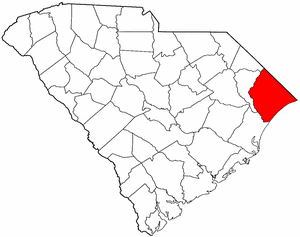
HORRY COUNTY SC Cemetery GPS Mapping Project
|
Paul Kankula ( NN8NN )
Webmaster |
|
Gary Flynn ( KE8FD )
GPS Mapping |
HORRY COUNTY SC Cemetery GPS Mapping Project
|
Paul Kankula ( NN8NN )
Webmaster |
|
Effective: 12/27/22 10:35 by: PMK |
USGS GEOGRAPHIC NAMES INFORMATION SYSTEM (GNIS) - POPULATED PLACES
https://geonames.usgs.gov/domestic/index.html
GOOGLE MAPS
It's very common for a cemetery to be known by several different names..!
If known, alternate names will be noted somewhere on the county's webpage listing.
Contact Gary Flynn at garyflynn44@yahoo.com, if all you know, is your cemetery's general area.
Cemetery names will normally be listed in alphabetical order. Ex: Brown-Jones-Wilson Families
Surnames will normally come before given names. Ex: Brown Family, John
Plantation names were not ordinarily shown on the Census. Using plantation names to locate ancestors can be difficult because the name of a plantation may have been changed through the years and because the sizeable number of large farms must have resulted in lots of duplication of plantation names.
Plantation nicknames names, if known, will normally be listed as aka (also known as).
It's assumed that if a plantation had over 100 enslaved workers, that there would have normally been a separate cemetery for them. Often landowner's family graves might be located nearby, but always kept separate.
Plantation homes were often burned after slave emancipation, because the landowner could no longer afford to pay their land taxes.
Historical home locations can normally be determined by locating their existing foundations.
|
Horry County Historical Society Cemetery Survey Book Surname Indexes Submitted by:
The following Surname Indexes WILL NOT provide you with an Individual's Date-of-Birth/Death. It will only tell you in what Cemetery Survey Book, your Surname can be found in and on what page number.
Book 1 = Waccamaw Records, Pub. # 6, Horry County, SC Cemetery Records, v. 1
Book 2 = Waccamaw Records, Pub. # 7, Horry County, SC Cemetery Records, v. 2
Book 3 = Waccamaw Records, Pub. # 8, Horry County, SC Cemetery Records, v. 3
Book 4 = Waccamaw Records, Pub. # 9, Horry County, SC Cemetery Records, v. 4
Book 5 = Waccamaw Records, Pub. # 10, Horry County, SC Cemetery Records, v. 5
Book 6 = Waccamaw Records, Pub. # 11, Horry County, SC Cemetery Records, v. 6
Book 7 = Waccamaw Records, Pub. # 12, Horry County, SC Cemetery Records, v. 7
Book 8 = Waccamaw Records, Pub. # 13, Horry County, SC Cemetery Records, v. 8
Book 9 = Waccamaw Records, Pub. # 14, Horry County, SC Cemetery Records, v. 9
Book 10 = Waccamaw Records, Pub. # 15, Horry County, SC Cemetery Records, v. 10 |
|
Book 1 |
Cover & Index |
A - | - Z | |||
|
Book 2 |
Cover & Index |
A - | - Z | |||
|
Book 3 |
Cover & Index |
A - | - Z | |||
|
Book 4 |
Cover & Index |
A - | - Z | |||
|
Book 5 |
Cover & Index |
A - | - Z | |||
|
Book 6 |
Cover & Index |
A - | - Z | |||
|
Book 7 |
Cover & Index |
A - | - Z | |||
|
Book 8 |
Cover & Index |
A - | - Z | |||
|
Book 9 |
Cover & Index |
A - | - Z | |||
|
Book 10 |
Cover & Index |
A - | - Z |
|
Family History Library - Books The Church of Jesus Christ of Latter-Day Saints
|
Research Notes:
Horry County was named for Revolutionary War hero Peter Horry (1743-1815). The county was originally a part of Georgetown District, and at one time it was called Kingston. It became a separate county in 1801, with the county seat at Conway. This area of the state was isolated for many years by numerous rivers and swamps, and the inhabitants sometimes referred to themselves as the "Independent Republic of Horry." Lumber and naval stores were the primary industries during the eighteenth and early nineteenth centuries, with tobacco farming being introduced later. In the twentieth century tourism has come to dominate the coastal section of the county centered around Myrtle Beach. Television personality Vanna White and science fiction writer William Gibson are natives of Horry County. (Submitted by: SC State Library / Mary Morgan, 31-Mar-2008)
(1) & (3) =
Some F-a-G cemetery name submittals only represent a plot (gathering) of family graves -- that's located within another cemetery!
Some F-a-G church name submittals only represent a church's building location -- that doesn't have an adjoining cemetery!
Some posted F-a-G GPS locations are very inaccurate and will rarely ever get corrected by its submitter!
(2) = Text File for miscellaneous information.
(3) = Horry County Find-a-Grave Project
(4) = Survey Book Code # = County # - Survey Book # - Page #
AME = African Methodist Episcopal(N) SMC = Southern Methodist Church UMC = United Methodist Church ME = Methodist Episcopal
Zion AME = Zion African Methodist Episcopal(N) CME = Christian Methodist Episcopal (N) = Negro (S) = Slave (C) = Caucasian (I) = Indian (A) = Asian
|
Ref. # |
Cemetery Name (1) |
GPS Mapping |
Aerial View |
Road Map |
Photos |
Text (2) |
Find a Grave (3) |
Survey Book (4) |
Location |
|
|
|
||||||||||
|
26-001 |
Abigail Family |
n33 55.113 , w78 45.686 |
|
|
F |
|
aka Abidail
E Bear Grass Rd, Longs |
|||
| 26-350 | Allen Family | n33 56.205 , w79 05.688 | A | M | F | 1000' sw of rt-319, 200' n of rt-22, conway bypass, Conway | ||||
|
26-002 |
Anderson Family #1 |
n33 59.017 , w78 59.267 |
|
|
F |
|
McNabb Rd, E of US 701, Loris |
|||
|
26-003 |
Anderson Family #2 |
n33 54.118 , w78 58.113 |
|
|
F |
|
Traviana Rd off Rt 19, Conway |
|||
|
26-004 |
Anderson Family, R.M. |
n33 58.233 , w78 59.706 |
||||||||
|
26-005 |
Antioch |
n34 00.633 , w78 49.600 |
|
|
F |
|
Rt 348 & Old Todd Ferry Rd, Loris |
|||
|
26-006 |
Antioch Baptist |
n34 01.450 , w79 11.683 |
|
|
F |
|
Hwy 129 & Pearl Rd, Aynor |
|||
|
26-007 |
Antioch UMC Methodist |
n33 51.517 , w79 12.750 |
|
|
F |
|
Antioch Rd, W of Oak Grove Rd, Conway |
|||
| 26-351 | Ark Plantation | n33 36.298 , w78 58.759 | A | M | F |
aka Floral, Arke, Roaches & Surfside Beachs cemetery area was primarily used for plantation workers, see memorial marker photo, 6th ave & mrtle dr, myrtle beach |
||||
|
26-008 |
Aynor Memorial |
n33 59.530 , w79 12.300 |
|
|
F |
|
Dawsey Rd. & 7th Ave, Conway/Aynor |
|||
|
26-009 |
Aynor Church of God |
n33 59.200 , w79 12.547 |
|
|
F |
|
Wside Jordanville Rd, Aynor |
|||
|
26-010 |
Bakers Chapel Baptist |
n33 57.014 , w79 03.569 |
|
|
F |
|
Bakers Chapel Rd, Aynor |
|||
| 26-352 | Baptist Colored Church | n33 59.440 , w79 14.818 | A | M | F | 150' s of frye rd, 0.8m e of pee dee rd, Galivants Ferry | ||||
|
26-011 |
Barfield Family |
Can't locate original cemetery |
|
|
|
|
|
cemetery was located in the Grainger Pond area. On the east side of Road 400 between 142 and 1024, graves moved to 26-257 Spring Branch Cemetery |
||
|
26-012 |
Barnhill-Martin Family |
n33 56.614 , w78 49.578 |
|
|
F |
|
Rt 348, across from Pleasant Hill Cem, Loris |
|||
|
26-013 |
Bayboro Baptist |
n34 00.350 , w79 01.233 |
|
|
F |
|
Rt 410 & Valley Forge Rd, Aynor |
|||
|
26-014 |
Beaty Family |
n34 05.940 , w79 02.281 |
|
|
|
SR917 sign says 200 D&J Rd, behind home, Nichols |
||||
|
26-019 |
Bell-Permenter |
n33 55.246 , w78 37.686 |
|
|
F |
|
near NC line, E of Wampee Rd, Little River |
|||
|
26-015 |
Bellamy Memorial, Charlie |
n33 55.433 , w78 43.700 |
|
|
F |
|
aka Brooks
Rt 9, S of Bucks Trail, Longs |
|||
|
26-097 |
Bellamy-Gore Family |
n33 52.645 , w78 37.235 |
|
|
F |
|
aka Mount Calvary
Bay dr, w of luck ave, Little River |
|||
|
26-016 |
Berea Baptist #1 |
n34 01.733 , w79 06.000 |
|
|
F ? |
|
Skipper Rd & Joyner Swamp Rd, Aynor |
|||
|
26-017 |
Berea Baptist #2 |
Can't locate cemetery |
|
|
|
|
|
On Old Ridge Rd, .5m from Dog Bluff |
||
|
26-020 |
Bethany Baptist |
n34 02.083 , w78 59.183 |
|
|
F |
|
Joyner Swamp Rd & Whispering Hills Rd, Loris |
|||
|
26-021 |
Bethel Baptist |
n33 57.209 , w79 13.051 |
|
|
|
aka Dog Bluff
On Old Ridge Rd, .5m from Dog Bluff |
||||
|
26-022 |
Bethel AME Methodist (N) |
n33 34.683 , w79 02.283 |
|
|
F |
|
McDowell Short Cut Rd. & Burgess Rd, Myrtle Beach |
|||
|
26-023 |
Bethehem Baptist (N) |
n33 54.220 , w78 54.180 |
|
|
F |
|
Rt 905 E of Rt 66, Conway |
|||
|
26-024 |
Beulah Baptist |
n33 58.083 , w78 53.367 |
|
|
F |
|
Rt 66 S of Cherrry Hill Rd, Loris |
|||
|
26-025 |
Beverly Family |
n33 45.215 , w79 09.480 |
|
|
F |
|
Beverly Rd E of Pawley Swamp Rd, Conway |
|||
|
26-026 |
Blanton Family #1 |
n34 08.400 , w78 58.922 |
|
|
F |
|
E of Olive Dr, Green Sea |
|||
|
26-027 |
Blanton Family #2 |
n34 09.317 , w79 03.867 |
|
|
|
Rd 26-19, Nichols |
||||
|
26-028 |
Booth Family |
n33 57.030 , w78 56.711 |
|
|
F |
|
Adrian Hwy, Conway |
|||
|
26-029 |
Boyd Family |
n34 02.659 , w78 54.610 |
|
|
F |
|
aka Cushion Swamp,
near Loris & 701 |
|||
|
26-030 |
Branton Family |
n33 50.548 , w78 53.264 |
|
|
F |
|
Tilly Swamp Rd, W of Bear Bluff Rd, Conway |
|||
| 26-355 | Bratcher Family | n33 43.054 , w79 10.115 | A | M | F | 3107 pee dee hwy, conway, behind ouseBucksport | ||||
| 26-356 | Bridge Memorial |
Can't locate cemetery |
F | Longs | ||||||
| 26-279 | Brinson Family | n34 00.589 , w78 52.057 | F |
|
||||||
|
26-031 |
Brown Swamp UMC Methodist |
n33 54.020 , w79 07.975 |
|
|
F
|
|
US 501 & Landmark Rd, Conway |
|||
|
26-032 |
Bryan Family |
n33 57.530 , w78 41.540 |
|
|
F |
|
Hwy 905 near N.C. Line, Longs |
|||
|
26-033 |
Buck Family Plot |
n33 42.970 , w79 04.072 |
|
|
F |
|
Bucksville Dr, across from Hebron Church, Conway |
|||
| 26-280 | Bucksport Memorial | n33 39.558 , w79 06.002 | F | Cemetery Rd, e of Bucksport Rd | ||||||
|
26-034 |
Buck Creek Baptist |
n33 57.075 , w78 43.440 |
|
|
F |
|
Hwy 905 & Buck Creek Dr, Longs |
|||
|
26-035 |
Buffkin Family #1 |
n34 11.591 , w78 58.311 |
|
F |
|
aka Turberville,
Fair Bluff Hwy, Green Sea |
||||
|
26-036 |
Buffkin Family #2 |
n34 13.000 , w78 58.397 |
|
|
|
Fair Bluff Hwy, Old Play Card Rd |
||||
|
26-037 |
BuffKin Family #3 |
n34 12.367 , w78 59.554 |
|
|
|
Brogin Rd, Green Sea, across from Stricklin #2 |
||||
|
26-038 |
Bug Swamp |
n33 58.240 , w78 59.654 |
|
|
F |
|
Hucks Rd, Across rd from R.M. Anderson, Conway |
|||
|
26-039 |
Bullard Family |
Can't locate cemetery |
|
|
|
|
|
3m SW of Finklea |
||
| 26-281 | Bullock-Gerald-Sanders Family | n34 07.283 , w79 03.130 | F | Faith Home rd, e of rt-19, Nichols, across from High Hill Baptist | ||||||
|
26-110 |
Bullard-Hammond Family |
n34 15.600 , w79 06.333 |
|
|
|
Coras landing Rd, W of Causey Rd, Nichols |
||||
|
26-040 |
Bunker Hill Memorial |
n33 50.146 , w79 13.277 |
|
|
F |
|
Pee Dee Rd, S of US 376, Conway |
|||
|
26-041 |
Butler Family |
n33 59.733 , w78 43.850 |
|
|
F |
|
W of Old Buck Creek Rd & Rose Wind Rd, Longs |
|||
| 26-357 | Calvary Baptist | n33 56.693 , w79 04.816 | A | M | F | n of bakers chapel rd, e of allen rd, Aynor | ||||
|
26-042 |
Calvary Free Will Baptist |
n34 07.483 , w79 07.150 |
|
|
F |
|
Calvary Church Rd, E of Willoughby Rd, Nichols |
|||
|
26-043 |
Camp Swamp UMC Methodist |
n34 00.890 , w78 44.750 |
|
|
F |
|
Old Buck Creek Rd, N of Pond Rd, Loris |
|||
|
26-044 |
Cane Branch AME Methodist (N) |
n33 48.391 , w79 10.590 |
|
|
F |
|
Cane Branch Church Rd, W of Hunting Swamp Rd, Conway |
|||
|
26-045 |
Cane Branch Baptist |
n34 00.200 , w78 56.517 |
|
|
F |
|
Cane Branch Rd & Gerald Dr, Loris |
|||
| 26-358 | Cannon Family |
Can't locate cemetery |
F | Loris | ||||||
|
26-046 |
Carolina Baptist |
n34 09.533 , w78 56.283 |
|
|
F |
|
Church Rd & 26-314, Green Sea |
|||
|
26-047 |
Carter Family |
n33 59.575 , w78 51.295 |
|
|
F |
|
Daisy Rd E of Red Blufff Rd, Loris |
|||
|
26-048 |
Causey Family |
Can't locate cemetery |
|
|
|
|
|
Intersection of S26-819 & S26-961 |
||
|
26-049 |
Cedar Bay Baptist |
n33 53.268 , w79 01.575 |
|
|
F |
|
E of Rainwood Rd & 26-813, Conway |
|||
|
26-050 |
Cedar Branch Missionary Baptist |
n33 59.720 , w78 46.304 |
|
|
F |
|
Cedar Branch Rd & Turkey Hollow Rd, Loris |
|||
|
26-051 |
Cedar Creek Memorial #1 |
n33 51.767 , w78 39.133 |
|
|
|
Hope Ln, Little River |
||||
|
26-052 |
Cedar Creek Memorial #2 |
n34 10.650 , w79 07.533 |
|
|
|
aka Stroud,
Nichols Hwy & Rockwood Rd, Nichols |
||||
|
26-053 |
Cedar Grove Baptist |
n33 50.150 , w79 10.640 |
|
|
F |
|
US 376, W of Antioch Rd, Conway |
|||
|
26-054 |
Centenary UMC Methodist |
n33 46.533 , w79 01.233 |
|
|
F |
|
Rt 544, S of Singleton Ridge Rd, Conway |
|||
|
26-055 |
Cherry Hill Missionary Baptist (N) |
n33 59.450 , w78 53.433 |
|
|
F |
|
Cherry Hill Rd, N of Dusty Rd, Loris |
|||
|
26-056 |
Chesterfield Missionary Baptist (N) |
n33 50.450 , w78 46.240 |
|
|
F |
|
Dewitt Rd, E of Old Chesterield Rd, Longs |
|||
|
26-057 |
Chestnut Memorial #1 |
n33 55.217 , w78 55.617 |
|
|
F |
|
26-472, W of Dexter Ln, Conway |
|||
|
26-058 |
Chestnut Memorial #2 |
n33 50.590 , w78 48.770 |
|
|
F ? |
|
Chestnut Rd, S of Oak Bay Dr,Longs |
|||
|
26-059 |
Chestnut, J.W. |
n33 54.080 , w78 55.768 |
|
|
F |
|
Mae Rd, N of Rt 905, Conway |
|||
|
26-060 |
Clardy Family |
n33 52.964 , w78 43.186 |
|
|
F |
|
near Crystal Ln & Tallwood Rd. |
|||
|
26-061 |
Cochran-Gowens |
n33 53.595 , w79 03.119 |
|
|
F |
|
Wetlands Industrial Park Rd, Conway |
|||
|
26-062 |
Collins-Fowler |
n34 07.840 , w78 56.520 |
|
|
F |
|
Hufford Rd, N of Hagan Rd, Loris |
|||
|
26-063 |
Collins Creek Baptist |
n33 35.967 , w79 03.667 |
|
|
F |
|
Rt 707, N of Longwood Dr, Myrtle Beach |
|||
|
26-314 |
Columbus County Singing Union Cemetery |
n34 08.670 , w78 53.230 |
|
|
|
located at end of Jarvis St, S of 2nd St, cemetery located in Horry County-SC, entrance to cemetery is actually located in Columbus County-NC, near Tabor County. |
||||
|
26-064 |
Conway 1st Methodist |
n33 50.233 , w79 02.867 |
|
|
|
5th Ave & Main St, Conway |
||||
|
26-065 |
Cook Family |
n34 59.070 , w79 12.050 |
|
|
F |
|
Webster Rd, w of us-501, Aynor |
|||
| 26-068 | Cool Springs Southern Methodist | n33 58.650 , w79 08.410 | F | Williams Rd, n of elm st, Cool Springs | ||||||
|
26-067 |
Cox Family |
33.95531, -78.71455 |
|
|
F |
|
aka East Side Buck Creek
Near 9 & 904 |
|||
|
26-359 |
Crawford Family |
Can't locate cemetery |
|
|
|
|
|
Cemetery is located somewhere near the intersection of Hwy 501 & Tobacco Leaf Lane (on the west side of Tobacco Leaf Ln.), Galivants Ferry |
||
|
26-069 |
Creekside Cemetery |
n33 56.545 , w78 49.581 |
|
|
F |
|
aka Oak Grove
McNeil Chapel Rd, N of Hardy Rd,Loris |
|||
| 26-281 | Davis Family | n33 50.554 , w79 04.271 | F | W of mill pond rd, s of forest view rd, Conway | ||||||
|
26-070 |
Dew Family |
n33 48.046 , w79 07.595 |
|
|
F |
|
Allen Dew Rd, W of Daw Rd, Conway |
|||
| 26-282 | Dimery Family | n33 57.747 , w79 13.043 | F | Rd 26-1048, e of dog bluff rd, Aynor | ||||||
|
26-071 |
Dorman Family |
n34 03.633 , w78 58.717 |
|
|
|
aka Holt,
Carriage Ln, W of Green Bay Rd, Loris |
||||
|
26-072 |
Durant Family |
n33 51.671 , w78 59.380 |
|
|
|
aka Geissette Landing
Eastside of SR905, across from Williams RV Park, Conway |
||||
| 26-360 | Eddy Lake Memorial | 33.64512, -79.10746 | A | M | F | |||||
|
26-073 |
Edge Family, Daniel |
n33 51.793 , w78 48.959 |
|
|
F |
|
E, Hwy 31 E, N of Rt 90, Longs |
|||
|
26-074 |
Edge Family #1 |
Can't locate cemetery |
|
|
|
|
|
On 65 |
||
|
26-075 |
Edge Family #2 |
n33 50.391 , w78 51.314 |
|
|
|
Reaves Perry Rd, E of Rt 90, Conway |
||||
|
26-076 |
Eddy Lake Cemetery |
DESECRATED 33.64512, -79.10746 |
|
|
|
aka Port Harrelson,
at Eddy Lake |
||||
|
26-077 |
Elliott Family |
n34 11.067 , w79 07.467 |
|
|
|
F |
|
aka Spring Hill,
26-23 S of Hibiscus Dr, Nichols |
||
|
26-078 |
Evergreen Original Free Will Baptist |
n33 53.300 , w79 07.067 |
|
|
F |
|
US 501 & Willie James Rd, Conway |
|||
| 26-362 | Faith Tabernacle | n33 57.644 , w79 10.758 | A |
|
F | e of us-501, s of william nobles rd, Aynor | ||||
| 26-363 | First Baptist of Conway | n33 50.268 , w79 03.066 | A | M | F | tombstones are now laying next to church wall, could have been moved when parking lot was built, elm st & 6th ave, Conway | ||||
|
26-079 |
Flag Patch Memorial |
n34 02.717 , w78 48.833 |
|
|
F |
|
N of Wayside Dr, E of N Flag Patch Rd, Loris |
|||
|
26-080 |
Floyd Family #1 |
n34 11.211 , w79 03.777 |
|
|
F |
|
Duford Rd, S of Rt 9, Nichols |
|||
| 26-366 | Floyds Freewill Baptist | n34 10.391 , w79 04.073 | F | ne of 3 bend rd, 500' e of duford rd, nichols, can no locate any cemetery | ||||||
|
26-081 |
Foley Family |
n34 13.142 , w78 58.889 |
|
|
F |
|
aka Matthews Family
N of Norton Rd,E of Lovett Rd |
|||
|
26-082 |
Folly Family |
n33 41.686 , w78 57.843 |
|
|
F |
|
W of Marina Dr, Myrtle Beach |
|||
|
26-083 |
Forest Lawn Cemetery |
n33 51.433 , w78 44.300 |
|
|
F |
|
Water Tower Rd, S of Rt 90, Longs |
|||
|
26-084 |
Fowler Family #1 |
n34 07.400 , w78 53.417 |
|
|
|
S of Dayton Dr, Loris |
||||
|
26-085 |
Fowler Family #2 |
n34 07.843 , w78 52.350 |
|
|
|
J&J Lane, E of Waccamaw Dr, Loris |
||||
|
26-086 |
Fox Branch Baptist |
n33 57.467 , w78 56.783 |
|
|
F |
|
Shannon Ln, E of Rt 19, Conway |
|||
|
26-087 |
Freemont Baptist (N) |
n33 56.199 , w78 45.002 |
|
|
F |
|
Freemont Rd, N of Paradise Ln, Longs |
|||
|
26-088 |
Freeworship Church |
n33 51.365 , w79 09.810 |
|
|
F |
|
Hampton Rd, S of Jeffords Dr, Conway |
|||
|
26-089 |
Galivants Ferry Baptist |
n34 02.633 , w79 15.317 |
|
|
F |
|
Pee Dee Rd S,, N of Amhurst Rd, Galivants Ferry |
|||
| 26-367 | Galloway Family | n33 49.359 , w78 54.385 | A | M | F | 600' w of pee dee rd & lake swamp rd, nichols | ||||
|
26-090 |
Garrald Family |
n34 06.338 , w79 12.283 |
|
|
|
Near 99 & 423, (Lk Swamp Rd & Pee Dee hwy, Nichols) |
||||
|
26-091 |
Gause Family #1 |
n33 50.948 , w78 59.770 |
|
|
F |
|
Near Hardee Ferry Rd & Wbury's Landing |
|||
|
26-092 |
Gause Family #2 |
n33 58.725 , w78 52.205 |
|
|
|
E of Ivy Ln, N of Neil Branch Rd, Loris |
||||
|
26-093 |
Gerald #1 |
n34 05.733 , w79 09.350 |
|
|
|
S of Ketchuptown Rd, Nichols |
||||
|
26-094 |
Gerald #2 |
n34 06.383 , w79 07.850 |
|
|
|
Lake Swamp Rd, W of Rt 917, Nichols |
||||
|
26-095 |
Gethsemane |
n34 03.250 , w79 08.567 |
|
|
F |
|
Barnhill Rd, E of Nichols Hwy, Aynor |
|||
| 26-369 | Gethsemane Freewill Baptist | n33 57.693 , w79 14.390 | A | M | F | pee dee rd, 0.5m s of pisgah church rd, Galivants Ferry | ||||
| 26-370 | Gober Family |
Can't locate cemetery |
F | 11840 Hwy 90, Little River, Little River | ||||||
|
26-096 |
Good Hope Baptist |
n33 56.844 , w78 58.473 |
|
|
F |
|
aka Woodlawn
Adrian Hwy, E of Prevetts Rd, Conway |
|||
| 26-371 | Gore-McLamb Family |
Can't locate cemetery |
F | Marshland rd, Aynor | ||||||
|
26-098 |
Grace Christian Fellowship |
n33 54.454 , w78 39.471 |
|
|
F |
|
Little River Rd & 26-57 |
|||
|
26-099 |
Graham Family #1 |
n33 51.283 , w78 55.117 |
|
|
|
Old Reaves Ferry Rd, E of Bratcher Rd, Conway |
||||
|
26-100 |
Graham Family #2 |
n34 07.250 , w78 53.667 |
|
|
|
aka Mount Beulah, Wigley Rd, Loris |
||||
|
26-101 |
Graham Family #3 |
n34 08.737 , w78 56.513 |
|
|
|
York Rd, N of Rt 410, Green Sea |
||||
|
26-102 |
Graham Family #4 |
n34 06.503 , w79 00.483 |
|
|
|
aka Old Graham
W of 26-792 & Galaxy Dr, Loris |
||||
| 26-068 | Graham Family #5 | n34 05.717 , w79 07.250 | S of farguson rd, s of sr-917, Nichols | |||||||
| 26-283 | Graham Family #6 | n33 51.334 , w79 09.791 | F | W of hampton rd & devon park dr, Conway | ||||||
|
26-103 |
Grainger Family #1 |
n33 54.160 , w78 50.580 |
|
|
|
S of Rt 905, W of Hwy 31 E, Conway |
||||
|
26-104 |
Grainger Family #2 |
n34 13.501 , w79 03.367 |
|
|
|
E of Duford Rd, S of Allspice Rd, Nichols |
||||
|
26-105 |
Greater Saint James Methodist (N) |
n33 52.490 , w79 04.167 |
|
|
F |
|
Oak St & Elics, Conway |
|||
|
26-106 |
Green Family |
n33 50.570 , w78 40.906 |
|
|
|
N of Sandridge Rd, Little River |
||||
|
26-107 |
Green Sea |
n34 07.783 , w78 58.400 |
|
|
F |
|
Green Sea Rd, N of Rt 410 |
|||
|
26-108 |
Griffin Family |
n34 17.217 , w79 04.290 |
|
|
F |
|
Griffins Landing Rd, W of Causey Rd, Nichols |
|||
|
26-109 |
Hamilton Family |
n33 57.783 , w78 59.183 |
|
|
F |
|
Privetts Rd, E of Hucks Rd, Conway |
|||
|
26-111 |
Hammond Family #1 |
n34 15.155 , w79 01.555 |
|
|
F |
|
Spring Branch Dr & Overbrook Rd, Nichols |
|||
|
26-112 |
Hammond Family #2 |
n34 05.203 , w78 59.079 |
|
|
F |
|
Fair Lane Rd, Loris |
|||
|
26-113 |
Happy Home Baptist |
n34 00.862 , w79 09.201 |
|
|
F |
|
aka Williamson
Rt 1115 & Nichols Hwy, Aynor |
|||
|
26-114 |
Hardee Family #1 |
n33 57.200 , w78 49.550 |
|
|
|
Rt 348, S of Pleasant Grove Rd, Loris |
||||
|
26-115 |
Hardee Family #2 |
n34 04.186 , w78 49.594 |
|
|
F ? |
|
Oakdale Rd, next to Oakdale Church Cem, Loris |
|||
|
26-116 |
Harrelson Family |
Can't locate cemetery |
|
|
|
|
|
Behind 3326 casdade rd, near pond, Loris |
||
|
26-117 |
Harrelson Family, Dr. D. |
n34 04.650 , w78 55.750 |
|
|
|
Rt 9 & Cyndi Ln, Loris |
||||
|
26-118 |
Hatcher Family #1 |
n33 56.096 , w79 12.554 |
|
|
F |
|
150' s of jeno rd, 500' w of hwy-984, galivants ferry |
|||
| 26-373 | Hatcher Family #2 | n34 14.130 , w79 00.158 | A | M | F | s of eugenes rd, at elliotts farm nursery, nichols | ||||
|
26-119 |
Hebron UMC Methodist |
n33 42.950 , w79 04.050 |
|
|
F |
|
aka Sandridge Community
Bucksville Dr, W of Old Buckville Rd, Conway/Bucksville |
|||
|
26-120 |
Hemingway Chapel AME Methodist (N) |
n33 49.190 , w79 05.120 |
|
|
F |
|
Cates Bay Hwy & Hemingway Chapel Rd, Conway |
|||
| 26-374 | Hemmingway Family | n33 50.301 , w79 03.817 | A | M | F | taylor square, n of durant st, Conway | ||||
|
26-121 |
Heniford Family |
DESECRATED
Can't locate cemetery |
|
|
|
|
|
aka Suggs |
||
|
26-122 |
Heavenly Hills |
34 03.074 , w78 49.810 |
|
|
F |
|
Log Cabin Rd, E of Rt 420, Loris |
|||
|
26-123 |
Hickory Grove Missionary Baptist (N) |
n33 52.467 , w78 58.600 |
|
|
F |
|
Rt 905 & Old Reaves Ferry Rd, Conway |
|||
|
26-124 |
High Point Baptist |
n33 53.280 , w79 13.040 |
|
|
F |
|
Juniper Bay Rd, W of Shady Grove Rd, Conway |
|||
|
26-125 |
Hilburn Family |
n33 55.122 , w78 45.769 |
|
|
|
e of Bear Grass Rd, Longs, across road from 26-001Abigail Cemetery |
||||
|
26-127 |
High Hill Baptist |
n34 07.283 , w79 03.117 |
|
|
F |
|
Faith home rd, e of rt-19, Nichols |
|||
|
26-128 |
Hill's Chapel Missionary Baptist (N) |
n34 10.415 , w79 04.080 |
|
|
F |
|
3 Bend Rd, E of Duford Rd, Nichols |
|||
|
26-129 |
Hillcrest Memorial |
n33 47.500 , w79 01.200 |
|
|
F |
|
Rt 544 & University Blvd, Conway |
|||
|
26-130 |
Hodge Family |
34.15372, -78.98240 |
|
|
|
On SR142, Myrtle Beach |
||||
|
26-131 |
Holly Hill Cemetery |
n34 00.750 , w78 52.083 |
|
|
F |
|
Holly Hill Rd, E of Red Bluff Rd, Loris |
|||
| 26-376 | Holmes Falily | n33 52.655 , w78 41.302 | A | M | F | s of calvary rd, 200' w of old sawmill circle, in side yard of home | ||||
|
26-132 |
Hooks Family |
n34 12.767 , w79 03.567 |
|
|
F |
|
Duford Rd, N of Pinckney Rd, Nichols |
|||
| 26-377 | Hucks Family | n33 56.679 , w79 09.289 | A | M | F | near corner of hucks rd & dear creek rd, ayno, no private residence | ||||
| 26-378 | Huffman Family |
Can't locate cemetery |
F | Aynor | ||||||
| 26-379 | Hughes Family | n33 56.597 , w78 49.616 | A | M | F |
aka Pleasant Grove w of mcneil rd, 1000' s of simpson creek, loris |
||||
| 26-380 | Ingram Family |
Can't locate cemetery |
F | Ingram Beach | ||||||
|
26-133 |
Jack's Branch |
n33 42.338 , w79 05.402 |
F |
|
|
|
500' s of bucksville dr & shelly farm rd, conway | |||
|
26-135 |
Jernigan Family |
n34 09.633 , w79 00.785 |
|
|
F |
|
Billy Mc Rd, E of Mt Olive Church Rd, Green Sea |
|||
|
26-136 |
Johnson-Thompson Family |
n34 04.222 , w79 05.265 |
|
|
F |
|
Hwy 308, E of Johnson Rd, Aynor |
|||
| 26-381 | Jordan Family, Abraham |
Can't locate cemetery |
F | Conway | ||||||
|
26-137 |
Juniper Bay Baptist |
n33 52.300 , w79 10.217 |
|
|
F |
|
Juniper Bay Rd & Miracle Ln, Conway |
|||
|
26-138 |
Kingston Presbyterian |
n33 50.167 , w79 02.700 |
|
|
F |
|
3rd Ave & Kingston, Conway |
|||
|
26-139 |
Kirton Family |
Can't locate cemetery |
|
|
|
|
|
On Old Pee Dee Rs, 6m S of 501, near Red Hill Methodist |
||
|
26-140 |
Lake Swamp Baptist |
n34 06.057 , w79 00.267 |
|
|
F |
|
Rt 917, E of Fairlane Rd, Loris |
|||
|
26-141 |
Lakeside Cemetery |
n33 50.678 , w79 02.724 |
|
|
F |
|
Near 9th & Hart St, in Conway |
|||
|
26-142 |
Lee Family |
n33 50.159 , w78 58.675 |
|
|
F |
|
Confederate Dr, W of Lee's Landing Cir, Conway |
|||
|
26-143 |
Lewis Family #1 |
n33 53.967 , w78 37.053 |
|
|
|
Lewisfield Rd, E of Mineola Ave, Little River |
||||
|
26-144 |
Lewis Family #2 |
n33 54.067 , w78 53.128 |
|
|
F |
|
Rt 905, on Doodle Hill Rd, Conway |
|||
|
26-145 |
Lewis Family #3 |
n34 09.369 , w79 09.486 |
|
|
|
M.W. Stroud Rd & Tranquil Rd, Nichols |
||||
| 26-382 | Little Bethel Freewill Baptist | n34 08.730 , w78 54.507 | A | M | F | w of little bethel rd, s of bertie rd, Green Sea | ||||
|
26-146 |
Little River UMC Methodist |
n33 52.633 , w78 36.850 |
|
|
F |
|
US 17 & Mineola Ave, Little River |
|||
|
26-147 |
Live Oak Baptist |
n34 03.367 , w78 56.483 |
|
|
F |
|
Live Oak Church Rd, N of Joyner Swamp Rd, Loris |
|||
| 26-155 | Live Oak Cemetery | n33 55.566 , w78 37.752 | S of Wampee Rd, W of NC State Line | |||||||
|
26-148 |
Livingston Family |
n33 50.477 , w78 49.910 |
|
|
F |
|
E of Edge Rd, S of Livingston Circle, Conway |
|||
|
26-149 |
Long Family |
n33 52.303 , w79 01.518 |
|
|
F |
|
S of Hunting Club Rd, E of Long Rd, Conway |
|||
| 26-383 | Longwood Family |
Can't locate cemetery |
F | Surfside Beach | ||||||
|
26-150 |
Lovette Family |
n34 11.546 , w78 58.286 |
|
|
F |
|
On 26-33, N of Glenwood Rd, Green Sea |
|||
| 26284 | Marlow Branch | n33 44.085 , w79 03.986 | F | W of Upper Mill Dr, E of Old Bucksville Rd, Conway | ||||||
|
26-151 |
Marlowe Family |
n34 01.067 , w78 44.250 |
|
|
F |
|
W of Marlowe Rd, at NC State Line, Longs |
|||
|
26-152 |
Martin Family #1 |
n34 04.600 , w79 07.070 |
|
|
|
aka Rodgers
Sarvis Rd, N of Rt 308, Galivants Ferry |
||||
|
26-153 |
Martin Family #2 |
n34 06.946 , w78 56.804 |
|
|
|
aka Grainger
E of Lake Circle, N of Rt9, Loris |
||||
|
26-154 |
Martin Family #3 |
Can't locate cemetery |
|
|
|
|
|
On 400 & off 76, Nichols |
||
|
26-156 |
McCracken Family #1 |
n33 52.873 , w79 05.514 |
|
|
F |
|
aka Cochran Town or Greenhole,
Tower Rd, E of Oak St,Conway |
|||
| 26-384 | McCracken Family #2 | n33 52.033 , w79 03.975 | A | M | F |
aka White Oak e of oak st, 600' n of skipper rd, conway |
||||
|
26-157 |
McNeill Family |
n33 49.263 , w78 55.697 |
|
|
F |
|
Left of 3154 Hwy 90, Conway |
|||
|
26-158 |
McNeil Chapel Missionary Baptist (N) |
n33 54.903 , w78 49.471 |
|
|
F |
|
N of Old Wilson Rd, E of McNeil Chapel Rd, Longs |
|||
|
26-159 |
Medlin Family |
Can't locate cemetery |
|
|
|
On 9, E of Sweet Home |
||||
| 26-385 | Murrell Memorial | 33.83127, -78.95641 | A | M | F | Myrtle Beach | ||||
| 26-386 | Meter Family | n33 53.107 , w78 35.932 | A | M | F | 100' n of visitor center on us-17, Little River | ||||
|
26-160 |
Milligan Family |
n34 01.362 , w78 45.628 |
|
|
|
In field betw2een Myrtle W Dr & Fries Bay Rd, Loris |
||||
|
26-161 |
Mills Family |
n34 08.155 , w79 00.412 |
A |
|
|
F |
|
At 9 & SR142, Green Sea |
||
|
26-162 |
Mincey Family |
n34 06.920 , w79 02.460 |
|
|
F |
|
On SR59, 1m N of 917 |
|||
| 26-387 | Mineral Springs | n33 41.757 , w79 07.432 | A | M | F | 1000' n of the end of bucksview rd, w of little lamb rd, conway | ||||
| 26-285 | Mishoe Family #1 | n33 58.927 , w78 54.004 |
A |
2300' W of Harvey Rd & Cherry Hill Rd, Loris | ||||||
| 26-388 | Mishoe Family #2 |
Can't locate cemetery |
Bucksprt/Allsbrook | |||||||
|
26-163 |
Mitchell Sea Baptist |
n34 06.980 , w78 58.730 |
|
|
F |
|
Mt Olive Church Rd, S of Livingston Ln, Nichols/Green Sea |
|||
|
26-164 |
Montgomery (N) |
n33 52.194 , w78 46.260 |
|
|
|
Pint Ct, Longs |
||||
|
26-165 |
Montgomery-Wilson Family |
n33 49.599 , w78 58.121 |
|
|
|
W of Sterritt Swamp Rd, N of Burris Rd, Conway |
||||
|
26-166 |
Moore's Cemetery |
n33 42.848 , w79 10.050 |
|
|
|
e of lucas bay rd, 250' s of pee dee rd, conway |
||||
|
26-167 |
Mount Ariel Original Free Will Baptist |
n33 55.217 , w79 04.433 |
|
|
F |
|
Rt 319 & Ole King St, Conway |
|||
|
26-168 |
Mount Calvery |
n33 53.800 , w78 38.367 |
|
|
|
Cemetery Rd, E of Little River Rd, near Blooms Dr, Little River |
||||
|
26-169 |
Mount Calvary Missionary Baptist |
n33 53.920 , w78 39.040 |
|
|
F |
|
Little River Rd N of Blooms Dr, Little River |
|||
|
26-170 |
Mount Calvary Missionary Baptist #1 (N) |
n33 54.067 , w78 52.817 |
|
|
|
Rt 905 E od Doodle Hill Ln, Conway |
||||
|
26-172 |
Mount Herman Baptist |
n33 54.785 , w79 13.760 |
|
|
F |
|
Bruncon Spring Rd, W of Jordanville Rd, Aynor |
|||
|
26-173 |
Mount Lebanon |
n33 55.418 , w78 47.671 |
|
|
F |
|
Rt 905, E of Heartside Rd, Longs |
|||
|
26-174 |
Mount Leon |
n33 55.467 , w78 47.267 |
|
|
F |
|
Rt 905, E of Harrelson Rd, Longs |
|||
|
26-175 |
Mount Moriah Missionary Baptist (N) |
n33 39.770 , w79 06.398 |
|
|
F |
|
Bucksport Rd & Isabella Dr, Conway |
|||
|
26-176 |
Mount Nebo Baptist |
n34 02.147 , w78 49.360 |
|
|
F |
|
Flag Patch Rd, S of Zeek Dr, Loris |
|||
|
26-177 |
Mount Olive Missionary Baptist (N) |
n34 08.925 , w79 01.910 |
|
|
F |
|
Mt Olive Church Rd, S of Jarrott Dr, Nichols |
|||
|
26-178 |
Mount Pillar |
n34 02.667 , w78 59.600 |
|
|
F |
|
aka Mount Pelley
S of Rt 19, Loris |
|||
|
26-179 |
Mount Pisgah Baptist (N) |
n34 06.650 , w79 09.367 |
|
|
F |
|
Nichols Hwy, S of Luck Rd, Nichols |
|||
|
26-180 |
Mount Pleasant Missionary Baptist |
n33 52.217 , w78 42.283 |
|
|
F |
|
Mt. Zion Rd, S of Hwy 57, Little River |
|||
| 26-390 | Mount Rona | n34 02.869 , w78 49.158 | A | M | F | w of flag patch rd, 1000' n of flag patch missionary baptist, loris | ||||
|
26-181 |
Mount Trolly Free Will Baptist |
n34 02.933 , w79 10.650 |
|
|
F |
|
Barnhill Rd, W of Joyner Swamp Rd, Galivants Ferry |
|||
|
26-182 |
Mount Vernon Missionary Baptist (N) |
n34 09.485 , w79 01.960 |
|
|
F |
|
Rt 9, N of Mount Olive Church Rd, Nichols |
|||
|
26-184 |
Mount Zion Baptist |
n34 06.350 , w78 57.000 |
|
|
F |
|
Mt Zion Rd & Clear Point Rd, Loris |
|||
|
26-185 |
Mount Zion AME Methodist (N) |
n33 51.250 , w78 41.933 |
|
|
F |
|
Stop Rd. N of Rt. 90, Little River |
|||
| Myrtle Beach Community Memorial | n33 44.250 , w78 56.300 | A | M |
aka Pine Island & Mount Carmel w of ronald mcnair blvd, n of christa mcauliffe st, myrtle beach |
||||||
|
26-186 |
New Bethel AME Methodist (N) |
n34 03.320 , w79 04.580 |
|
|
|
aka Bethel Chapel or Silver
Bethel Chapel Rd. E of Mill Pond Rd. |
||||
|
26-187 |
New Home Baptist |
n33 57.783 , w78 55.917 |
|
|
F |
|
Dows Rd & Cane Branch Rd, Loris |
|||
|
26-188 |
New Home Full Gospel |
n34 04.485 , w79 10.167 |
|
|
F |
|
aka Christian Fllowship
On 308, W of Amber Ln, Aynor |
|||
| 26-287 | New Hope AME Methodist (N) | n34 01.160 , w79 01.295 | F | Green Sea Rd, N of Joyner Swamp Rd, Loris | ||||||
|
26-189 |
New Hope Missionary Baptist |
n33 48.017 , w79 09.195 |
|
|
F |
|
Near 5500 Kates Bay Rd, Conway |
|||
|
26-190 |
Nixon Family |
n33 49.558 , w78 54.214 |
|
|
F |
|
N of Rt-90, E of River Pine Dr, Conway |
|||
|
26-191 |
North Myrtle Beach Memorial Garden |
n33 51.633 , w78 39.483 |
|
|
F |
|
Rt 9, N of Rt 90, Little River |
|||
|
26-192 |
Oak Dale Missionary Baptist |
n34 04.200 , w78 49.617 |
|
|
F |
|
Oak Dale Rd, W of Franklin Dr, Loris |
|||
| 26-391 | Oak Grove Baptist Pleasant View | n34 06.625 , w79 07.920 | A | M | F | 500' n of rt-017, w of lake swan rd, nichols | ||||
|
26-193 |
Oak Grove Original Free Will Baptist |
n33 51.202 , w79 11.793 |
|
|
F |
|
5920 Antioch Rd, Conway |
|||
|
26-194 |
Oak Grove Missionary Baptist |
n33 52.389 , w78 57.680 |
|
|
F |
|
Rodney Rd, near Old Reeves Ferry Rd |
|||
|
26-195 |
Oakey Swamp Baptist |
n33 50.610 , w79 08.010 |
|
|
F |
|
Juniper Bay Rd, N of Roena Dr, Conway |
|||
|
26-196 |
Oak Street Cemetery |
n33 42.417 , w78 52.550 |
|
|
F |
|
aka Convention Center
Oat Street, behind Convention Center, Myrtle Beach |
|||
|
26-197 |
Ocean View Memorial |
n33 48.650 , w78 42.470 |
|
|
F |
|
aka Edge
US 17 at 20th Ave, N Myrtle Beach |
|||
|
26-198 |
Ocean Woods Memorial Park |
n33 40.167 , w78 54.917 |
|
|
F |
|
aka Misway
US 17 & 25th Ave S, Myrtle Beach |
|||
|
26-199 |
Old Stevens Family |
n33 56.876 , w78 55.347 |
|
|
|
New Home Circle, 500' w of adrain hwt, conway |
||||
|
26-200 |
Old Strickland Family |
n34 05.901 , w79 04.763 |
|
|
|
800' n of rt-917, 500' w of grainger rd, nichols |
||||
|
26-201 |
Our Lady Star of the Sea Catholic |
n33 50.057 , w78 40.234 |
|
|
F |
|
Columbarium, 8th Ave N, N Myrtle Beach |
|||
| 26-392 | Owens Family | n33 40.708 , w79 06.515 | A | M | F | n of mishoe rd, 500' e of bucksport rd, conway | ||||
|
26-202 |
Parker Family |
n34 16.183 , w79 04.933 |
|
|
|
E of Causey Rd, N of Howard Rd, Nichols |
||||
|
26-203 |
Patterson Family |
n34 03.000 , w78 53.400 |
|
|
|
Meadow St, E of Red Bluff Rd, Loris |
||||
| 26-393 | Paul Family, Larry | n33 41.344 , w79 02.442 | A | M | F | 6085 peachtree rd, Myrtle Beach | ||||
|
26-204 |
Pauley Swamp Baptist |
n33 45.450 , w79 11.117 |
|
|
F |
|
Pauley Swamp Rd, E of Pee Dee Rd, Conway |
|||
|
26-205 |
Pee Dee Free Will Baptist |
n33 50.002 , w79 08.065 |
|
|
F |
|
US 378, E of Smokehouse Circle, Conway |
|||
| 26-394 | Pine Island Memorial | 33.73795, -78.93930 | A | M | F |
aka Community Memorial Myrtle Beach |
||||
|
26-206 |
Pisgah UMC Methodist |
n33 57.917 , w79 13.883 |
|
|
F |
|
Pisgah Church Rd & Dog Bluff Rd, Aynor |
|||
|
26-207 |
Platt Family |
n33 53.650 , w78 39.267 |
|
|
F |
|
Bloom Dr, W of Little River Rd, Little River |
|||
|
26-209 |
Pleasant Hill Missionary Baptist |
n33 54.317 , w78 51.183 |
|
|
F |
|
Rt 905, E of Rt 22, Conway |
|||
|
26-210 |
Pleasant Meadow Baptist |
n34 04.567 , w78 59.067 |
|
|
F |
|
Rt 410, N of Coates Rd, Loris |
|||
|
26-211 |
Pleasant Plain Baptist |
n33 54.967 , w78 39.933 |
|
|
F |
|
Albert Rd & Little River Rd, Little River |
|||
|
26-212 |
Pleasant View Baptist |
n34 05.883 , w79 03.817 |
|
|
F |
|
Rt 19 & Calvary Church Rd, Nichols |
|||
|
26-213 |
Pleasant Union Missionary Baptist |
n33 59.817 , w79 06.583 |
|
|
F |
|
Pleasant Union Rd & Minnick Rd, Aynor |
|||
|
26-214 |
Pondfield Memorial |
n33 55.590 , w78 54.572 |
|
|
F |
|
Ashley Circle Rd, W of Rt 66, Conway |
|||
|
26-215 |
Popular AME Methodist (N) |
n33 51.270 , w78 45.985 |
|
|
F |
|
Rt 90 ,E of Livingston Ln, Longs |
|||
|
26-216 |
Poplar UMC Methodist |
n33 56.183 , w79 02.050 |
|
|
F |
|
US 701 &Poplar Church rd, Aynor |
|||
|
26-217 |
Port Harrelson |
n33 39.992 , w79 07.954 |
|
|
F |
|
Port Harrelson Rd, Conway |
|||
|
26-218 |
Price Family |
n33 52.221 , w78 57.711 |
|
|
F |
|
Old Reaves Ferry Rd, E of Russell Rd, Conway |
|||
|
26-219 |
Prince's Creek |
n33 36.181 , w79 04.330 |
|
|
F |
|
aka Black Moor
Longwood Dr, Myrtle Beach |
|||
|
26-220 |
Princeville |
n34 04.645 , w78 55.780 |
|
|
F |
Rt 90 & Melvin Way, Loris |
||||
| 26-395 | Rabb Family |
Can't locate cemetery |
F | Little River | ||||||
|
26-221 |
Ray Family |
n34 03.424 , w79 03.200 |
|
|
F |
|
N of Moody Rd, W of Martin-Bell Ln, Loris |
|||
|
26-222 |
Reaves Family #1 |
n33 51.150 , w78 53.683 |
|
|
|
Inman Circle, N of Old Reaves Ferry Rd, Conway |
||||
|
26-223 |
Reaves Family #2 |
n34 00.183 , w78 51.767 |
|
|
|
W of Rt 66, S of Holly Hill Rd Loris |
||||
|
26-224 |
Red Hill UMC Methodist |
n34 00.033 , w79 15.467 |
|
|
F |
|
Pee Dee Rd, S of St. John Rd, Galivants Ferry |
|||
|
26-225 |
Red Oak |
n34 03.850 , w79 02.200 |
|
|
F |
|
aka Strickland #1,
off 19, W of Playcard Crossroads |
|||
|
26-226 |
Rehobeth Baptist |
n33 57.217 , w79 13.433 |
|
|
F |
|
Dog Bluff Rd & Jonestown Rd, Aynor |
|||
|
26-227 |
Rehoboth UMC Methodist |
n34 03.150 , w79 08.817 |
|
|
F |
|
Barnhill Rd & Nichols Hwy, Aynor |
|||
|
26-228 |
Rehoboth UMC Methodist Annex |
n34 03.089 , w79 08.680 |
|
|
F |
|
Rehobeth Methodist Rd, Aynor, E of church |
|||
|
26-229 |
Ridgefield Baptist |
n33 49.467 , w79 00.150 |
|
|
F |
|
Rt 90, at Wilderness Rd, Conway |
|||
|
26-230 |
Riverside Memorial |
n34 13.367 , w79 07.217 |
|
|
F |
|
Rt 9 near US 76, Nichols |
|||
|
26-232 |
Rose Hill Memorial Gardens |
n33 50.261 , w79 04.495 |
|
|
F |
|
Rosehill Rd & Grainger Rd, Conway |
|||
|
26-233 |
Royals Memorial |
n33 54.097 , w78 52.075 |
|
|
F |
|
Royals Circle,off 905, Conway |
|||
| 26-398 | Saint Elizabeth | n33 59.555 , w79 11.230 | A | M | F | gun st, e of rosedale dr, Aynor | ||||
|
26-234 |
Saint James Catholic (Columbarium) |
n33 48.290 , w79 02.085 |
|
|
F |
|
1070 Academy Dr, Conway |
|||
|
26-235 |
Saint Joseph Missionary Baptist (N) |
n33 50.230 , w78 41.630 |
|
|
F |
|
Old Sanders Rd, Little River |
|||
| 26-440 | Saint John's Freewill Baptist | n34 00.265 , w79 14.068 |
A |
F | St John Rd, W of Higgins Shortcut Rd, Galivants Ferry | |||||
|
26-236 |
Saint Matthew's Missionary Baptist (N) |
n33 58.101 , w79 08.034 |
|
|
F |
|
Elm St, N of Garner Rd, Aynor |
|||
| 26-292 | Saint Michael's Catholic (Columbarium) | n33 35.395 , w79 00.242 | F | Cypress Ave & Bleiler Ave, Garden City | ||||||
|
26-237 |
Saint Paul AME Methodist (N) |
n33 52.210 , w78 37.690 |
|
|
F |
|
US 17, W of Horseshoe Dr, Little River |
|||
| 26-399 | Saint Paul's Anelican (Columbium) | n33 50.470 , w79 02.994 | A | M | F | us-701 & lakewood ave, Conway | ||||
|
26-238 |
Saint Paul's Missionary Baptist |
n33 53.316 , w79 02.150 |
|
|
F |
|
3949 Highway 65, Conway |
|||
| 26-401 | Saint Peter AME Methodist (N) | n33 58.233 , w79 08.048 | A | M | F |
aka Cool Springs elm st & enoch rd, aynor |
||||
| 26-402 | Saint Philip Lutheran (Columbium) | n33 44.187 , w78 49.873 | A | M | F | n of kings hwy & 63rd ave, Myrtle Beach | ||||
| 26-403 | Saint Stephen AME Methodist (N) | n34 02.722 , w78 48.704 | A | M | F | 200' e of flag patch cemetery rd, n of wayside dr, loris | ||||
|
26-239 |
Saint Stephens Episcopal (Columbarium) |
n33 49.807 , w78 39.920 |
|
|
F |
|
11 Ave N, N Myrtle Beach |
|||
|
26-240 |
Salem Missionary Baptist |
n33 57.233 , w79 07.633 |
|
|
F |
|
Salem Rd & Rt 319, Aynor |
|||
|
26-241 |
Salem AME Zion Methodist (N) |
n33 49.345 , w78 57.198 |
|
|
F |
|
aka Salem UMC Methodist ?
Rt 90, at Sterritt Swamp Rd, Conway |
|||
| 26-404 | Salem AME Methodist (N) | n33 39.971 , w79 06.221 | A | M | F | salem church rd, e of bucksport rd, conway | ||||
|
26-243 |
Sandy Plain UMC Methodist |
n34 03.850 , w79 13.250 |
|
|
F |
|
Pee Dee Hwy,W of Best Rd, Galivants Ferry |
|||
|
26-244 |
Sarvis Family |
n33 56.115 , w78 53.909 |
|
|
F |
|
E of Rt-66, N of W G Rd, Conway |
|||
|
26-245 |
Sessions Family |
n33 53.763 , w79 04.665 |
|
|
|
Norris Rd, Conway |
||||
| 26-405 | Shannon Family | n34 03.348 , w78 56.460 | A | M | F | e of live oak church rd, s of coats rd, live oak | ||||
|
26-246 |
Sharon Baptist |
n33 51.405 , w78 48.108 |
|
|
F |
|
Rt 90 E of Meadowood Ln, Longs |
|||
|
26-247 |
Silent Grove Cemetery |
n34 06.750 , w78 58.700 |
|
|
F |
|
Rt 410, S of Rt 9, Loris |
|||
|
26-248 |
Silent Grove Baptist |
n34 06.033 , w78 59.017 |
|
|
F |
|
Rt 917, W of Hands Dr, Loris |
|||
|
26-250 |
Simpson Creek Primitive Baptist |
n33 59.233 , w78 50.200 |
|
|
|
F |
|
Daisy Rd & Simpson Creek Dr, Loris |
||
|
26-251 |
Singleton Family #1 |
n33 44.722 , w79 01.355 |
|
|
|
On 544, S of Conway, near Gravelly Gully Circle |
||||
|
26-252 |
Singleton Family #2 |
n33 45.390 , w79 05.820 |
|
|
|
Tranquil Rd, S of Harper Rd, Conway |
||||
| 26-407 | Small Family |
Can't locate cemetery |
F | Nichols | ||||||
|
26-253 |
Smith Family |
n33 59.997 , w78 44.160 |
|
|
|
Coney Dr, Longs |
||||
|
26-254 |
Socastee UMC Methodist |
n33 41.017 , w79 00.150 |
|
|
F |
|
Baggott Ln, W od Dick Pond Ln, Myrtle Beach |
|||
|
26-256 |
Southern Palms Memorial Gardens |
n33 47.917 , w78 44.850 |
|
|
F |
|
aka Southeasters Memorial
W of US 17, at Ocean Creek Dr, N. Myrtle Beach |
|||
|
26-257 |
Spring Branch Baptist |
n34 15.550 , w79 02.100 |
|
|
F |
|
Spring Branch Rd, E of US 76, Nichols |
|||
| Spain Family, Skipper | n33 51.662 , w79 06.476 | A | M | F | end of blue rd ln, e of cocksford ln, Conway | |||||
|
26-258 |
Springfield |
n34 03.183 , w78 48.950 |
|
|
|
Log Cabin Rd & Meadowood Ln, Loris |
||||
|
26-259 |
Stalvey Family |
n33 41.362 , w78 59.139 |
|
|
F |
|
off Shem Creek Circle, Myrtle Beach/Socastee |
|||
|
26-260 |
State Branch #1 |
n34 08.867 , w79 10.183 |
|
|
|
W end of Hardwick Rd, Nichols/Conway |
||||
|
26-261 |
State Branch #2 |
n33 44.603 , w79 07.754 |
|
|
|
N of Beverly Rd, Conway |
||||
|
26-262 |
Stephens Family |
n33 53.020 , w78 41.086 |
|
|
F |
|
aka Gerrald
S of Rt 57, E of Rt 9, Little River |
|||
|
26-263 |
Stevens Family |
n33 59.717 , w78 56.217 |
|
|
F |
|
Cane Branch Rd, N of Sern Crest Dr, Loris |
|||
|
26-264 |
Strickland #1 |
n34 03.850 , w79 02.200 |
|
|
|
aka Red Oak Cemetery
Lilly Pond Rd, N of Rt 19, Loris |
||||
|
26-265 |
Strickland #2 |
n34 12.400 , w78 59.550 |
|
|
|
Brogin Rd, Green Sea, across from Buffkin Cem. |
||||
| 26-409 | Stoney Point Memorial |
Can't locate cemetery |
F | |||||||
| 26-293 | Surfside UMC Methodist (Columbarium) | n33 37.299 , w78 58.235 | F | US-17 B & 17th Ave, Surfside Beach | ||||||
|
26-266 |
Sweet Home Freewill Baptist |
n33 41.292 , w79 01.512 |
|
|
F |
|
Peachtree Rd & Sweet Home Church Rd, Myrtle Beach |
|||
|
26-267 |
Sweetwater Branch Baptist |
n33 46.767 , w79 01.417 |
|
|
F |
|
Kimberly Dr, W of Rt 544, Conway |
|||
| 26-411 | Tampico Plantation |
Can't locate cemetery |
F | |||||||
|
26-268 |
Thompkins Family |
n33 48.667 , w78 58.117 |
|
|
F |
|
aka Montgomery
end of Mill Hill Rd, Conway |
|||
|
26-269 |
Thompson Family |
n33 55.150 , w79 00.417 |
|
|
F |
|
Rt 65, E of Boggy Rd, Conway |
|||
|
26-270 |
Tilly Swamp Baptist |
n33 50.197 , w78 53.233 |
|
|
F |
|
Todd Rd. N of Rt 90, Conway |
|||
| 26-412 | Tindal Family | n33 47.293 , w79 04.446 | A | M | F | copperhead rd, 500' n of ireland, conway | ||||
|
26-271 |
Todd Family |
n33 54.161 , w78 53.751 |
|
|
|
w of Fowler Rd, Conway |
||||
|
26-272 |
Todd-Sharon Family |
n33 51.391 , w78 48.093 |
|
|
F |
|
Rt 90 E of Meadowood Ln, Longs |
|||
|
26-273 |
True Vine Missionary Baptist |
n33 49.350 , w78 54.368 |
|
|
F |
|
Rt 90, E of Wild Horse Rd, Conway |
|||
| 26-413 | Trueway Holiness | n33 51.502 , w78 42.086 | A | M | F | s of punk rd, 150' w of mount zion rd, little river | ||||
|
26-274 |
Twin City Memorial Gardens |
n34 06.033 , w78 52.450 |
|
|
F |
|
US 701, N of Rt 9, Loris |
|||
| 26-286 | Union Chapel AME Methodist (N) | n34 02.633 , w79 13.500 | F | Hwy-129, E of Jacks Lookout Rd, Galivants Ferry | ||||||
|
26-275 |
Union UMC Methodist |
n33 46.846 , w79 04.335 |
|
|
F |
|
US 701, S of Copperhead Rd, Conway |
|||
|
26-276 |
United Missionary Baptist |
n33 51.198 , w78 48.929 |
|
|
F |
|
aka Edge,
Monaca Dr, S of Rt 90, Longs |
|||
|
26-277 |
Unknown Graveyard |
n33 42.084 , w78 59.085 |
|
|
|
S of Oak Manor Dr, Myrtle Beach |
||||
|
26-278 |
Unknown Black Cemetery |
n33 59.456 , w79 14.830 |
|
|
|
S of Frye Rd, W of Pee Dee Rd, Aynor |
||||
|
26-288 |
Unknown Name #10 |
n33 51.556 , w78 45.765 |
|
|
|
Della Rd, S of Brinkley Rd, Longs |
||||
|
26-289 |
Unknown Name #11 |
n33 51.440 , w78 42.050 |
|
|
|
W of Mt Zion Rd, S of Punk Rd, Little River |
||||
|
26-299 |
Unknown Name #21 |
n33 56.620 , w78 49.880 |
|
|
|
E of Little Hal Ln, E of Red Bluff Rd, Loris |
||||
|
26-301 |
Unknown Name #23 |
n33 57.310 , w78 42.870 |
|
|
|
On northside of Rt-905, W of Old Buck Ck, Longs |
||||
|
26-307 |
Unknown Name #29 |
n34 01.780 , w78 47.450 |
|
|
|
900' E of Johnson Ln, N of Hulls Island Rd, Loris |
||||
|
26-313 |
Unknown Name #35 |
n34 08.561 , w78 54.980 |
|
|
|
900' N of Rt-410, .25 mile E of Hwy 26-646, Green Sea |
||||
|
26-316 |
Unknown Name #38 |
n34 13.000 , w78 58.397 |
|
|
|
Eside of Fair Bluff Rd(26-33) just before state line |
||||
|
26-318 |
Unknown Name #40 |
n34 15.040 , w79 02.770 |
|
|
|
Eside of Jordan Creek Rd,E of US 76. |
||||
|
26-319 |
Unknown Name #41 |
n34 16.870 , w79 04.470 |
|
|
|
just E of Causey Rd. on Dead Ridge Rd. |
||||
|
26-320 |
Unknown Name #42 |
n34 07.540 , w78 54.060 |
|
|
|
3800' W of Mt Beulah Rd & Dayton Rd, Green Sea |
||||
|
26-323 |
Unknown Name #45 |
n33 51.410 , w78 46.680 |
|
|
|
Vereen Ave, CV Ln, Longs |
||||
|
26-324 |
Unknown Name #46 |
n34 02.900 , w78 56.620 |
|
|
|
W of Goose Bay Rd. |
||||
|
26-325 |
Unknown Name #47 |
n34 09.200 , w78 56.160 |
|
|
|
between Elliott Rd & Church Rd. |
||||
|
26-326 |
Unknown Name #48 |
n34 09.380 , w78 54.080 |
|
|
|
SE of Carolina Rd on County Line |
||||
|
26-328 |
Vaught Family |
n33 51.331 , w78 47.211 |
|
|
F |
|
At 3990 Hwy 90, Longs |
|||
|
26-329 |
Vereen Family |
n33 51.682 , w78 53.227 |
|
|
F |
|
at Bear Bluff Rd, Conway |
|||
|
26-330 |
Vereen Memorial Gardens |
n33 52.892 , w78 35.745 |
|
|
F |
|
Vereen Rd, SE of US 17, Little River |
|||
|
26-331 |
Waccamaw Presbyterian |
n33 41.867 , w79 06.667 |
|
|
F |
|
US 701, N of Port Harrelson Rd, Bucksport |
|||
| 26-414 | Waller Memorial | n33 53.086 , w79 04.519 | A | M | F | behind homes on southside of silver peak dr, w of oak st, Conway | ||||
|
26-332 |
Wampee UMC Methodist |
n33 51.583 , w78 43.351 |
|
|
F |
|
Rt 90, E of Old Wampee Rd, Little River |
|||
| 26-415 | Watts Family #1 |
Can't locate cemetery |
F | |||||||
| 26-416 | Watts Family #2 |
Can't locate cemetery |
F | Wampee | ||||||
|
26-333 |
Westside Memorial Gardens |
n33 51.068 , w79 05.392 |
|
|
F |
|
W Rd, W of Acie Ave, Conway |
|||
| 26-340 | White Savannah Free Will Baptist | n34 10.883 , w79 04.633 | F | Sand Dollar Dr, E of SR-65, Conway | ||||||
|
26-334 |
Williamson Family |
n34 09.367 , w78 59.600 |
|
|
F |
|
W of Olive Dr, N of Sea Breeze Dr, Green Sea |
|||
|
26-335 |
Willow Springs UMC Methodist |
n33 49.526 , w79 04.793 |
|
|
F |
|
aka Campground Cemetery,
9th Ave, at Townsend, Conway |
|||
| 26-337 | Wise Family | n34 10.883 , w79 04.633 | F |
aka Soles and Mad-Wise Rt-19, N of Lane's End Dr, Nichols |
||||||
|
26-336 |
Withers Family |
n33 41.380 , w78 53.568 |
|
|
F |
|
aka Myrttle Beach First Baptist
Withers Swash Dr & Collins St, Myrtle Beach |
|||
| Woodland Memorial | n33 57.563 , w78 59.161 | A | M | F | 200' s of whispering woods rd, 700' w of privetts rd, conway | |||||
|
26-338 |
Zion Cemetery |
n34 01.600 , w79 15.833 |
|
|
F |
|
aka Zion Methodist
Pee Dee Rd, N of Zion Rd, Aynor |
|||
|
26-339 |
Zoan UMC Methodist |
n34 03.933 , w79 03.200 |
|
|
F |
|
Rt 19, E of Barnhill Rd, Loris |
|||
|
|
||||||||||
|
|
|
|
|
|
|
|
26-450 |