|
Gary Flynn ( KE8FD )
GPS Mapping |
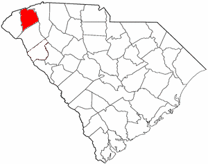
PICKENS COUNTY SC Cemetery GPS Mapping Project
|
Paul Kankula ( NN8NN )
Webmaster |
|
Gary Flynn ( KE8FD )
GPS Mapping |
PICKENS COUNTY SC Cemetery GPS Mapping Project
|
Paul Kankula ( NN8NN )
Webmaster |
|
Effective: 06/04/23 08:10 by: PMK |
USGS GEOGRAPHIC NAMES INFORMATION SYSTEM (GNIS) - POPULATED PLACES
https://geonames.usgs.gov/domestic/index.html
GOOGLE MAPS
It's very common for a cemetery to be known by several different names..!
If known, alternate names will be noted somewhere on the county's webpage listing.
Contact Gary Flynn at garyflynn44@yahoo.com, if all you know, is your cemetery's general area.
Cemetery names will normally be listed in alphabetical order. Ex: Brown-Jones-Wilson Families
Surnames will normally come before given names. Ex: Brown Family, John
Plantation names were not ordinarily shown on the Census. Using plantation names to locate ancestors can be difficult because the name of a plantation may have been changed through the years and because the sizeable number of large farms must have resulted in lots of duplication of plantation names.
Plantation nicknames names, if known, will normally be listed as aka (also known as).
It's assumed that if a plantation had over 100 enslaved workers, that there would have normally been a separate cemetery for them. Often landowner's family graves might be located nearby, but always kept separate.
Plantation homes were often burned after slave emancipation, because the landowner could no longer afford to pay their land taxes.
Historical home locations can normally be determined by locating their existing foundations.
|
Old Pendleton District Chapter of SC Genealogical Society Cemetery Survey Book Surname Indexes Submitted by: LaMarr Brooks
The following Surname Indexes WILL NOT provide you with an Individual's Date-of-Birth/Death. It will only tell you in what Cemetery Survey Book, your Surname can be found in and on what page number.
Book B01 (B01) = Pickens County Cemeteries, (294 pages)
Book B02 (B02) = Pickens County Cemeteries, (277 pages)
Book B03 (B03) = Pickens County Cemeteries, (118 pages)
Book B04 (S01) = Pickens County Cemetery Supplement, (244 pages)
Book B05 (L01) = Pickens County Liberty Memorial Gardens Cemetery, (38 pages)
Book B06 (G01) = Pickens County Greenlawn Memorial Park Cemetery, (147) Pages)
Book B07 (A01) = Pickens County African-American Cemeteries, (255 pages)
|
|
Book B01 (B01) |
| |||||
|
Book B02 (B02) |
|
|
| |||
|
Book B03 (B03) |
|
|
| |||
|
Book B04 (S01) |
||||||
|
Book B05 (L01) |
None |
|
|
| ||
|
Book B06 (G01) |
None |
|||||
| Book B07 (A01) |
|
Family History Library - Books The Church of Jesus Christ of Latter-Day Saints
|
Research Notes:
Pickens County was named for Revolutionary War hero Andrew Pickens (171817). The county seat is the town of Pickens. This area in the northwestern corner of the state was Indian territory until 1777. It subsequently became part of Pendleton District (at one time called Washington District). In 1826 Pendleton was divided into two counties, Pickens and Anderson; the western portion of Pickens County was later split off to form Oconee County (1868). The earliest European settlers in this region were Indian traders. The British built Fort Prince George around 1753 as protection against the Indians, and the fort was the site of several battles in the Cherokee War of 1760-62. The Cherokee town of Old Seneca was later destroyed by American troops in 1776. John C. Calhoun (1782-1850), United States vice president, senator, and cabinet member, made his home at Fort Hill plantation in Pickens County. His son-in-law, Thomas Green Clemson (1807-1888), bequeathed the plantation to the state for use as an agricultural college, which led to the founding of Clemson University. (Submitted by: SC State Library / Mary Morgan, 31-Mar-2008)
(1) = Some family cemetery names might only represent a plot (gathering) of family graves,
that are located within a different name & larger cemetery.
(2) = Text File for miscellaneous information.
(3) = Pickens County Find-a-Grave Project
(4) = Old Pendleton District Genealogical Society Cemetery Survey
Survey Book Code # = County # - Survey Book # - Page #
AME = African Methodist Episcopal (N) SMC = Southern Methodist Church UMC = United Methodist Church ME = Methodist Episcopal
Zion AME = Zion African Methodist Episcopal (N) CME = Christian Methodist Episcopal (N) = Negro (S) = Slave (C) = Caucasian (I) = Indian (A) = Asian
E-Mail: kankula@bellsouth.net TO REPORT BROKEN LINKS
|
Ref # |
Cemetery Name (1) |
GPS Mapping |
Aerial View |
Road
Map |
Photos |
Text (2) |
F-a-G (3) |
Survey (4) |
Location |
|
|
|
|
|
|
|
|
|
| |
|
P211 |
Abbott Cemetery (lot sales) |
N34 46.890 , W82 42.406 |
|
B04-P123 B04-P121 |
W of Old Norris Rd, S of Westview (new), Liberty | ||||
|
P321 |
Abbott Cemetery (1924) |
N34 46.975 x W82 42.295 |
|
|
|
N of Old Norris Rd, behind homes on W of Summit St | |||
|
Abel Baptist (1868) |
34.6933250 , -82.8032000 |
Clemson, remodeled (1946) | |||||||
|
P047 |
Abel Baptist (2nd location) (N) (1969) |
N34 41.600 , W82 48.210 |
B07-P051 |
aka Labelle / Label Baptist
Abel Rd & Raven Ln, E of Rt 93, Clemson | |||||
|
P192 |
Alexander Family |
Can't locate cemetery |
|
B01-P001 |
Near Crow Creek Rd & Shady Grove Rd, Sunset, in woods behind 2790 Shady Grove | ||||
|
P155 |
Alexander Family, Daniel |
N34 55.024 , W82 50.039 |
B03-P084 |
300 ft. N of Shady Grove Rd, W of Little Eastatoee Rd, Sunset | |||||
|
P156 |
Alexander-Dodson-Powell Family |
N35 02.454 , W82 48.342 |
B03-P083 |
1000 ft N on Spencers Alley, W of US 178, S of Rocky Bottom | |||||
|
P002 |
Alexander-Ellenburg Family |
N34 53.939 , W82 51.532 |
|
1000 ft S of Augusta Way, E of Steele Ct "The Reserve", Sunset | |||||
|
P003
|
Alice Mill Union Methodist (1911)
|
N34 49.981 , W82 37.485
|
B01-P002 |
aka Alice Union Baptist aka McKissick Chapel Methodist (1956)
Low Ave & Dunkin St, Easley | |||||
|
P158 |
Allgood Family, Alexander |
N34 52.725 , W82 44.943 |
B03-P092 |
600 ft N. end of Holder Knob Rd, N of Rt 183, Pickens | |||||
|
P326 |
Ambler Family (Slaves) (N) |
N34 57.238 , W82 40.916 |
|
|
10-15 field stone markers, 200' N of 274 Tater Hill Mountain Rd, 300' W of drive to home | ||||
|
P108 |
Anderson-Alexander-Barton-Ellenburg-Nimmons Family |
N34 58.631 , W82 51.310 |
|
B01-P027 B03-P092 |
aka Nimmons
W of Cleo Chapman Rd, S of Ellenburg Rd, Sunset | ||||
|
P004 |
Antioch Baptist (1st)
Antioch Baptist (1826) (2nd) |
N34 57.946 , W82 49.750
N34 57.639 , W82 49.691 |
B01-P007
B04-P079 |
aka P199 Winchester Family
Eastatoee Creek Rd, S of Rt11, Pickens | |||||
|
P005 |
Antioch UMC Methodist (1830) |
N34 51.460 , W82 31.126 |
B01-P003 B04-P083 |
aka New Hope Methodist (1800-1830) (changed name)
W of Antioch Rd, N of Saluda Dam Rd, Easley | |||||
|
P159 |
Archer-Barton Family |
N34 50.298 , W82 34.457 |
B01-P014 |
Between Darleen Ave & Lehigh Ln, Easley | |||||
|
P006 |
Ariail Family, John (1848) |
N34 50.574 , W82 38.730 |
B01-P009 |
aka Ariail-Henricks Family
N of Rt 8, 100 ft W of Breazeale Rd, Easley | |||||
|
P007 |
Arial UMC Methodist (1929) |
N34 50.428 , W82 38.346 |
B01-P143 B04-P033 |
aka Arial Baptist (1929-1949) aka Damascus Methodist aka Arial Union
S of Rt 8 behind Church, Easley | |||||
|
P008 |
Baker Family |
N34 53.983 , W82 44.032 |
B01-P011 |
S of Red Hill Rd, W of Tiger Dr, Pickens | |||||
|
P009
|
Ballentine Family
|
N34 44.492 , W82 46.606
|
B01-P012 B03-P096 |
aka 12-Mile Cemetery aka Mount Zion Methodist (1820's)
W of Johnson Rd & Sourwood Dr, Central | |||||
|
P010 |
Barrett Family |
N34 55.268 , W82 34.238 |
B01-P014 |
300 ft W of Old Dacusville Rd, N of Bonaventure Glen Ct, Easley | |||||
|
P256 |
Bethany UMC Methodist |
Can't locate cemetery |
|
|
B03-P091 |
Estimate 6 miles east of Pendleton | |||
|
P013 |
Bethel Baptist |
N34 54.845 , W82 53.771 |
B02-P142 |
W of Old Shallowford Rd, 1.2 miles S of Rt 11, Sunset | |||||
|
P275 |
Bethel Community (N) |
N34 51.596 , W82 42.175 |
B07-P171 |
Church purchased P014 Bethehem Methodist, Bethlehem Church Rd, Pickens | |||||
|
P014 |
Bethlehem UMC Methodist (1802) (Caucasian area) |
N34 51.626 , W82 42.184 |
B03-P093 B04-P024 |
aka Tatum Brush Arbor
E of Rt 183, Pickens | |||||
|
P014n |
Bethlehem UMC Methodist (Negro area) |
N34 51.596 , W82 42.175 |
|
|
B07-P171 B04-P024 |
Bethlehem Church Rd, E of Rt 183, Pickens; building sold to P275 Bethel Community | |||
|
P015
|
Black's Chapel UMC Methodist
|
N34 46.974 , W82 37.342
|
B04-P010 |
aka Mount Calvary Pilgrim Holiness (purchased church) aka Mount Calvary Wesleyan (purchased church)
Rt 135 & Mount Calvary Church Rd, Easley | |||||
|
P254 |
Blue Ridge View Baptist (1916) |
N34 55.305 , W82 37.832 |
B01-P015 |
aka Hickory Nut Mountain Memorial
Anthony Rd & Wolf Creek Rd, Pickens | |||||
|
P016 |
Boggs Family, Aaron |
N34 41.262 , W82 48.858 |
B01-P001 |
E of Fabrica Dr, S of Summery St, Clemson | |||||
|
P223 |
Boggs Family, G. Allan |
N34 46.845 , W82 51.604 |
Lonesome Pine Rd, E of Old Seneca Rd, behind home, Central | ||||||
|
P017 |
Boggs Family, Jane |
N34 45.168 , W82 40.592 |
|
B02-P166 |
In small stand of trees 1000 ft SW of Cassell Rd, Liberty | ||||
|
P018 |
Boggs Family, M. Joseph |
N34 44.975 , W82 39.615 |
B02-P038 |
S of Shady Manor Ln, E of Rt 178, Liberty | |||||
|
P293 |
Boggs Family, Peter (N) |
Can't locate cemetery |
|
|
|
|
|
B07-P149 |
CEMETERY DESECRATED ?
1m N of Liberty, behind 104/106 Ivyway St. |
|
P019 |
Boggs-Garner Family |
N34 44.981 , W82 42.018 |
B01-P015 B01-P125 |
E of Ruhamah Rd, 1000 ft S of US123, Liberty | |||||
|
P020 |
Bolding-Garrett-Hunnicutt-Morgan Family |
N34 50.402 , W82 47.075 |
B01-P016 |
S of Hudson Ln, W of Praters Creek Rd, Pickens | |||||
|
P241 |
Boroughs-Gillespie Family |
N34 50.683 , W82 46.055 |
|
B01-P016 |
E of Woodside Rd & Brahman Rd, Pickens | ||||
|
P300 |
Bowen Family |
n34 45.660 , w82 45.253 |
|
B03-P083 |
CEMETERY DESECRATED ?
near corner of Rt 93 & Rt 137, Norris | ||||
|
P162 |
Bowen-Clayton-O'Dell Family (1854) |
N34 49.317 , W82 43.747 |
|
|
aka Stephen Clayton Family
E of Roanoke Rd, S of Gilstrap Rd, Liberty | ||||
|
P298 |
Boyd Family |
N34 55.848 , W82 36.372 |
F |
CEMETERY DESECRATED ?
N of Rt 186 & Heavens Way, Easley | |||||
|
P163 |
Brock Family |
n34 45.756 , w82 45.158 |
B03-P083 |
CEMETERY DESECRATED ?
near Rt 93 & Winding Creek Rd, Norris | |||||
|
P023 |
Brown Family |
N34 56.607 , W82 40.166 |
B01-P017 |
E of Rt 8 & Ossie Hayes Rd, Pickens | |||||
| P187 |
Brown-Simmons Family |
Can't locate cemetery |
|||||||
| P188 |
Burdine Family |
Can't locate cemetery |
|||||||
|
P297 |
Butler Family, Eli H. (1831) (N) |
N34 59.255 , W82 50.779 |
100 ft N of Cleo Chapman Rd, across from Eastotee Bapt, Sunset | ||||||
|
P189 |
Calhoun Plantation (Salves) |
N34 40.558 , W82 50.566 |
B07-P141 |
(In Oconee County before 1968 -- see C245)
Woodland Dr, W of Williamson Dr, Clemson | |||||
|
P025 |
Camp Creek Baptist |
N34 47.270 , W82 47.252 |
B01-P076
B03-P096
B04-P034 |
aka Camp Creek Methodist (1899)
Rt 137 & Camp Creek Rd, Central | |||||
|
P164 |
Cannon Family, Darcus Bowen (grave) |
N34 57.118 , W82 44.946 |
B03-P088 |
100 ft N of Montvale School Rd, E of Meece Mill Rd, Pickens | |||||
|
P101 |
Cannon-Morgan Family |
N34 46.925 , W82 51.128 |
|
250 ft N of Jones Mill Rd, E of Old Seneca Rd, Central | |||||
|
P026 |
Carmel Presbyterian (1820) Carmel Presbyterian (1787) |
N34 45.342 , W82 38.499 |
|
T1 T2 |
B02-P166 B04-P011 |
aka Carmel Presbyterian (1787) aka A225 Pickens Chapel
Carmel Church Rd, E of Rt 135, Liberty | |||
|
P304 |
Cedar Hill Holiness |
N34 49.965 , W82 49.249 |
W of Cedar Hill Rd, S of Rt 183, Six Mile | ||||||
|
P027 |
Cedar Rock Baptist (1902) |
N34 52.305 , W82 36.804 |
B01-P144 B04-P005 |
Cedar Rock Church Rd, W of Holly Bush Rd, Easley | |||||
|
P168 |
Chandler Family, J.J. (1912) |
N34 49.342 , W82 43.761 |
E of Roanoke Rd, S of Gilstrap Rd, Liberty, next to Bowen-Clayton | ||||||
|
P051 |
Chapman Family |
N34 57.721 , W82 44.529 |
500 ft N of Cove Creek Rd, E of Rt 183, E of power line, Pickens | ||||||
|
P270 |
Chapman Family |
N34 58.218 , W82 45.043 |
100 ft E of Rt 178, S of Holly Springs School Rd, Pickens | ||||||
|
P165 |
Chastain Family |
N34 59.634 , W82 43.474 |
|
F |
B01-P024 |
S of Rt 288, 1.7 miles E of Rt 178, Pickens | |||
|
P021 |
Chastain Family, John |
N35 00.344 , W82 40.790 |
F ? |
B03-P092 |
W of Carrick Creek Rd, N of Rt 288, Pickens | ||||
| P190 |
Church of God of Prophency |
34.7962860 , -82.8183080 |
aka Six Mile Church of God of Prophency
| ||||||
|
P029 |
Clayton Family, Alfred (1884) |
N34 49.852 , W82 42.868 |
B01-P152 |
S of Odell Dr at Greenbriar Dr, in front yard, north of Pickens | |||||
|
P166 |
Clayton Family, Phillip |
N34 49.341 , W82 45.876 |
|
|
B03-P090 |
700 ft N of Stewart Gin Rd, E of Praters Creek, NW of Liberty | |||
|
P030 |
Clayton Family, Silas |
N34 44.923 , W82 43.156 |
|
|
B02-P164 |
N of Chastain Rd, W of Winding Creek Rd, Liberty | |||
|
P032 |
Clayton Family, William (1845) |
N34 47.092 , W82 45.770 |
B01-P025 |
aka Clayton-Robinson Family
E of Robinson Bridge Rd, S of Riverdale Rd, N of Norris | |||||
|
P028 |
Clayton Family, William W. (1897) |
N34 47903 , W82 45.770 |
E of Robinson Bridge Rd, S of Riverdale Rd, N of Norris | ||||||
|
P033 |
Clement Family |
N34 52.760 , W82 43.702 |
B01-P025 |
400 ft, N of Rt 183, W of Shady Grove Rd on hill, Pickens | |||||
|
P291 |
Clement Family, John L. |
N34 53.575 , W82 32.122 |
|
N of Rt 183 on Thomas Mill Rd, in woods next to church, Easley | |||||
|
P045 |
Cold Spring Baptist (1870) (N) |
N34 55.672 , W82 43.085 |
B07-P044 |
E of Cold Spring Church Rd, N of Midway Rd, Pickens | |||||
|
P228 |
Colhoun Family, John Ewing |
N34 42.264 , W82 51.376 |
B01-P025 |
Plantation, 1.5 miles SW on Doyle Bottom Rd, off Old 6 Mile Rd, Central | |||||
|
P035 |
Concord Baptist (1888) |
N34 53.084 , W82 45.679 |
B01-P026 B04-P052 |
W of Concord Church Rd, N of Acres Dr, Pickens | |||||
|
P253 |
Concord Family |
34.7044000 , -82.8562670 |
|
3m W of Pickens | |||||
|
P036 |
Couch Family, John Sr. |
N34 48.232 , W82 33.445 |
B01-P025 B03-P067 |
In backyard of home at 206 Pine Ridge Rd, W of Crestview Rd, Easley | |||||
|
P167 |
Couch Family, Robert |
N34 47.659 , W82 33.862 |
|
B03-P068 |
E of Bushy Creek Rd, S of Sheffield Rd, Easley | ||||
|
P037 |
Cove Creek Baptist |
N34 57.677 , W82 44.077 |
|
B02-P085 B04-P061 |
N of Cove Creek Rd, E of US 178, Pickens | ||||
|
C043 |
Craig Family |
N34 47.489 , W82 53.261 |
|
B01-P230 |
(In Oconee County)
N of Rt 183 behind Old Pickens Presbyterian Church, Seneca | ||||
| P191 |
Crenshaw Family |
Can't locate cemetery |
Pickens | ||||||
|
P038
|
Cross Roads Baptist (1924) (4th location)
|
N34 54.486 , W82 36.002
|
B01-P103 B04-P084 |
aka Cross Roads Meeting House (1798) (1st location) aka P198x Cross Roads Church of Christ (1814) (2nd location) aka Mark Freeman Family (2nd location) aka Cross Roads Baptist (1872) (3rd location)
E of Rt 135, N of Banks Rd, Easley | |||||
|
P192 |
Cross Roads UMC Methodist |
Can't locate cemetery |
|
|
|
|
|
|
W of Pickens, location reported by Era Davis |
|
P039 |
Crow Creek Church of God (c.1935) |
N34 52.134 , W82 50.359 |
B01-P026 |
W of Crow Creek Church Rd, N of Miles Creek Rd, Six Mile | |||||
|
P225 |
Cunningham Family, Andrew (grave) |
Can't locate cemetery |
B03-P089 |
Frank Hinton found tombstone in a ditch located back of his garage, Frank then put the tombstone in in his garage for safe keeping. Frank is now deceased and the tombstone can't be found. | |||||
|
P287 |
Dacus Family |
N34 54.207 , W82 32.642 |
aka Aiken-Dacus-Smith Family
At end of gravel Rd, N of Memory Ln, near Mt Carmel Bapt. Easley | ||||||
|
P040 |
Dacusville UMC Methodist (1856) |
N34 55.883 , W82 33.441 |
B01-P083 B04-P077 |
aka P007 Arial Methodist
Thomas Mill Rd, S of Rt 166, Easley | |||||
|
P041 |
Day Family |
N34 49.493 , W82 33.820 |
B02-P038 |
W of Powdersville Rd, S of Rt 123, Easley | |||||
|
P328 |
Doyle Family |
N34 42.261 , W82 50.804 |
|
|
Hunting Arrow Trail, off Doyle Bottom Rd, N of Clemson | ||||
| P193 |
Duncan Family, Trotter |
Can't locate cemetery |
|
||||||
|
P289 |
Durham Family |
N34 51.144 , W82 50.962 |
|
400 ft W of Crowe Creek Rd, S of Hunting Hollow Rd, Six Mile | |||||
|
P170 |
Easley Family |
N34 49.473 , W82 29.247 |
B03-P086 |
Waverly Dr, E of S.Crosswell Dr, Easley | |||||
|
P042
|
Easley Mill Union Church |
N34 49.127 , W82 36.630
|
B01-P122 |
Union Church for Baptist, Methodist & Wesleyan, at end of W. 7th Ave, Easley | |||||
|
P043 |
Eastotoe Baptist (1900) |
N34 59.250 , W82 50.726 |
B01-P002 B07-P180 |
Cleo Chapman Rd, E of Mill Creek Rd, Sunset | |||||
|
P230 |
Ellenburg-Holden Family |
N34 53.429 , W82 52.000 |
B02-P142 |
On Sunrise Ridge Rd, "The Reserve at Lake Keowee", Sunset | |||||
|
P171 |
Ellison Family |
N34 47.965 , W82 31.870 |
B03-P086 |
Til House Ct, N of Brenley Ln, E of Mossey Smith Rd, Easley | |||||
|
P044 |
Enon Baptist (1851) |
N34 50.238 , W82 38.973 |
B01-P092
B04-P032
B07-P175 |
Enon Church Rd, S of Breazeale Rd. Easley | |||||
|
P046 |
Fairview Baptist (1954) |
N34 48.186 , W82 45.722 |
|
B01-P028 B04-P062 |
aka Fairview Methodist (1832-1954)
E of Robinson Bridge Rd, S of Liberty Hwy, Liberty | ||||
|
P221 |
Fairview Independent Baptist |
N34 57.339 , W82 38.739 |
B01-P027 B04-P221 |
aka Morgan & Reid Family
cemetery does not belong to the church, Fairview Dr, E of Connelly Rd, Pickens | |||||
|
P263 |
Faith Baptist (1949) |
N34 45.948 , W82 45.870 |
|
aka Gospel Tabernacle (1947-1949) aka Faith Baptist Memorial
next to Norris Cemetery, Norris | |||||
|
P172 |
Ferguson Family |
N34 53.759 , W82 40.251 |
|
B03-P090 |
E of Banks Rd, off Boggs Rd, Pickens | ||||
|
P234 |
Fields Family, W.T. |
N34 53.625 , W82 38.045 |
B01-P010 |
400 ft S of Jameson Rd & Boundary Dr, Easley | |||||
|
P214
|
First Baptist Church of Liberty (1780) |
N34 46.915 , W82 42.270 |
|
|
aka Liberty First Baptist aka Bethehem Baptist aka Liberty Cemetery aka West View Cemetery aka Westview Cemetery
W of Stone St, N of P213 West View Cemetery | ||||
|
P049 |
Flat Rock Baptist (est. 1870 Section) |
N34 45.001 , W82 39.700 |
F |
B01-P125 B04-P012 |
aka P048 Flat Rock Baptist
W of US 178, S of Flat Rock Rd, Liberty | ||||
|
P048 |
Flat Rock Baptist (est. 1961 Section) |
N34 45.062 , W82 39.627 |
|
B04-P012 |
aka P049 Flat Rock Baptist
Between US 178 & Rt 135, s of Flat Rock Rd, Liberty | ||||
|
P050 |
Folly Hill Cemetery |
N35 04.634 , W82 46.710 |
B01-P014 |
Left of VanClayton Hwy, look for gate, near NC border, Rocky Bottom | |||||
|
P251 |
Fort Hill Presbyterian Columbarium |
N34 41.147 , W82 50.224 |
College Ave & Edgewood Ave, Clemson | ||||||
|
P173 |
Fortner-Fowler-Waldrop Family |
N34 52.704 , W82 36.077 |
B03-P091 |
aka Fortner or Fowler Family
E of Cannery Rd, 1000 ft, E of Rt 135, Easley | |||||
|
P226 |
Freeman Family, Benton |
N34 55.933 , W82 38.710 |
|
B01-P061 |
aka Mark Freemen Family
S of Rt 186, W of Chinquapin Rd, Pickens | ||||
|
P174 |
Friendship UMC Methodist (1830-1866)
P052 Friendship Methodist (1865-1955) |
N34 58.841 , W82 48.537
N34 58.661 , W82 47.682 |
A1
A2 |
M1
M2 |
P1
P2 |
|
F |
B03-P082 |
aka P052 Gilstrap-Walker Family
N of Sequoyah Way, W of Sunset Comm. Rd, Sunset |
|
P052
|
Friendship UMC Methodist (1865-1955)
|
N34 58.661 , W82 47.682
|
B01-P034 B04-P106 |
500 ft S of Rt 11, E of Eastatoee Creek Rd, Sunset | |||||
|
P053 |
Gap Hill Baptist (1954) |
N34 49.738 , W82 51.661 |
|
B01-P034 B03-P094 B04-P001 |
aka Gap Hill Methodist before 1954
Gap Hill Rd, N of Rt 183, Six Mile | ||||
|
P054 |
George's Creek Baptist (1859) |
N34 51.035 , W82 32.552 |
B02-P174 B04-P080 |
Saluda Dam Rd, E of Hinton Rd, Easley | |||||
| P194 |
Gilstrap Family |
34.9240660 , -82.5642160 |
Easley | ||||||
| P195 |
Givens Family |
35.0471528 , -82.7986272 |
Sunset | ||||||
|
P235
|
Glassy Mountain UMC Methodist
|
N34 55.456 , W82 40.005
|
B01-P002 |
aka Hendricks Family aka Glassy Mountain Community
200 ft E of Rt 186 & Rhymes Rd, Pickens | |||||
|
P055 |
Glenn-Hendricks Family |
N35 00.850 , W82 36.404 |
B02-P164 |
N of Rt 288, .8 miles W of County Line, Pickens | |||||
|
P056 |
Glenwood Mill Union Memorial (1908) |
N34 50.406 , W82 35.709 |
B01-P009 |
aka P180 Rhodes Family
W of Beverly Rd, S of Olive St, Easley | |||||
|
P160 |
Golden Creek Baptist (1890-1978) |
N34 47.517 , W82 44.827 |
|
|
B01-P071 B04-P023 |
aka P057 Golden Creek Baptist (1978)
400 ft, N of Golden Creek Rd & Hunter Mill Rd, E of church, Liberty | |||
|
P057 |
Golden Creek Baptist (1978) |
N34 47.451 , W82 44.824 |
aka P160 Golden Creek Baptist (1890-1978)
Golden Creek Rd & Hunter Mill Rd, next to church, Liberty | ||||||
|
P058 |
Golden Grove Wesleyan (1895) |
N34 45.364 , W82 39.647 |
B01-P031 |
US 178 & Yates Rd, Liberty | |||||
|
P303 |
Grace Baptist |
N34 47.079 , W82 38.365 |
|
B04-P159 |
Old Pendleton Rd, W of McAlister Rd, Liberty | ||||
|
P061 |
Greenlawn Memorial Park |
N34 49.392 , W82 37.266 |
|
G01-P000 |
Old Liberty Rd & Wallace Dr, Easley | ||||
|
P060 |
Gravely Family |
N34 59.805 , W82 46.809 |
|
N of US 178 & Sunset Community Rd, Sunset | |||||
|
P062 |
Griffin Baptist (1857) |
N34 55.734 , W82 40.201 |
|
B01-P043 B04-P066 |
Rt 8 & Griffin Church Rd, Pickens | ||||
| P196 |
Griffin Ebenezer Baptist |
34.8780610 , -82.7067770 |
Pickens | ||||||
| P197 |
Griffin Family |
Can't locate cemetery |
Pickensville | ||||||
|
P063 |
Hagood Family, Benjamin |
N34 56.573 , W82 42.110 |
B01-P180 |
aka Johnson Family aka Hightower Family aka Hagood Plantation
E of Midway Rd, S of Cove Creek Rd, Pickens | |||||
|
P063s |
Hagood Plantation (Slaves) (N) |
N34 56.573 , W82 42.110 |
|
B07-P144 |
Graves located outside fenced in area | ||||
|
P064 |
Hallum Family |
N34 45.928 , W82 40.667 |
B01-P001 |
S of US 123 on hill, 1000 ft W of 5 Forks Rd, Liberty | |||||
|
P261 |
Hebron Baptist (1888) |
N34 47.452 , W82 52.213 |
F |
aka P302 Samuel Youngblood Family
200 ft, E of Jones Mill Rd, near powerlines, Six Mile | |||||
|
P066 |
Hendricks-Prater Family |
N34 46.353 , W82 43.437 |
B03-P054 |
S of Old Norris Rd, behind Champion Plant, next to RR, Liberty | |||||
|
Herd Family |
Can't locate cemetery |
|
B03-P092 |
In Old Pickens area | |||||
|
P067 |
Hester Family |
N34 50.359 , W82 43.816 |
|
B01-P038 |
E of Roanoke Rd, S of Belle Shoals Rd, beside home, Liberty | ||||
|
P069 |
Hill Family |
N34 54.757 , W82 34.503 |
|
B01-P010 B03-P096 |
E of Old Dacusville Rd, N of Hestor Store Rd, in woods, Easley | ||||
|
P070 |
Hillcrest Memorial Park |
N34 51.773 , W82 41.081 |
|
Rt 8 & Bethlehem Ridge Rd, Pickens | |||||
|
P071 |
Holcombe Family |
N34 51.609 , W82 33.614 |
|
B01-P002 |
N of Lenhardt Rd, 1000 ft, E of Old Mill Rd, in woods, Easley | ||||
|
P072 |
Holly Springs Baptist |
N34 59.287 , W82 45.192 |
B02-P050 B04-P108 |
US 178 & Rt 288, Pickens | |||||
|
P198 |
Hinkle Family |
Can't locate cemetery |
|
|
B02-P142 |
CEMETERY DESECRATED ? | |||
|
P259 |
Hunt Family |
N34 53.730 , W82 30.797 |
Alex Ln & Edinburg Ln, inside Hunt Memorial Cemetery, Easley | ||||||
| P199 |
Hunt Family, Esli Jr (1869) |
Can't locate cemetery |
Dacusville | ||||||
|
P285 |
Hunt Family, John T.K. Harleston |
N34 58.043 , W82 32.503 |
3722 Earls Bridge Rd, (Rt 186), near county line, Easley | ||||||
|
P284 |
Hunt Family, John Wesley |
Can't locate cemetery |
|
CEMETERY DESECRATED ?
Dacusville area | |||||
|
P149 |
Hunt-Whitmire Family |
N34 58.845 , W82 32.797 |
|
F |
B02-P196 |
700 ft, E of Freeman Bridge Rd, N of Pace Bridge Rd, Easley | |||
|
P074 |
Hunt's Memorial Baptist (1934) |
N34 53.730 , W82 30.794 |
B01-P030 B04-P084 |
Alex Ln & Edinburg Ln, Easley | |||||
|
P229 |
Jameson Family |
N34 52.508 , W82 35.102 |
B01-P039 B04-P159 |
200 ft W of Jameson Rd, N of Holly Bush Rd, Easley | |||||
|
P075 |
Jamison Family (N) |
N34 43.995 , W82 46.019 |
|
B07-P116 |
Ridgecrest Cir & Lawton Rd, next to New Olive Grove Bapt. Central | ||||
| P200 |
Jessies Family |
Can't locate cemetery |
|||||||
|
P244 |
Johnston Family |
N34 44.241 , W82 43.704 |
B01-P014 |
1500 ft SE of Kennel Dr, S of Chastain Rd, Liberty | |||||
|
P201 |
Jones Family |
N34 58.305 , W82 36.300 |
F |
B01-P068 B03-P096 |
aka Captain Jones Family
300 ft, W of Hamilton Rd, N of Dalton Rd, Easley | ||||
|
P201 |
Jones Family |
|
|
3m SW of Six-Mile, 0.5m W of Kings Grove Baptist on Jones Mill Rd | |||||
|
P240 |
Jones Hill Church of God |
N34 59.109 , W82 34.758 |
F |
B04-P071 |
Dalton Rd & McConnell Rd, Easley | ||||
|
P245 |
Keith Family, Samuel (N) |
N35 00.211 , W82 42.872 |
B03-P067 B07-P146 |
aka Goob
400 ft N of Sliding Rock Rd, N of Rt 288, Pickens | |||||
|
P034 |
Kelly Family, Will |
N34 45.867 , W82 49.972 |
|
Pleasant Hill Church Rd, W of 6 Mile Hwy, Central | |||||
|
P078
|
Kennemer-Kennemore-O'Dell Family |
N34 49.048 , W82 39.205
|
|
B01-P197 B03-P094 |
CEMETERY DESECRATED
aka Kennemore Family
1200 ft N of Old Liberty Rd, east of Land Fill, Liberty | ||||
|
P079 |
Keowee River Baptist (1791) |
N34 51.683 , W82 52.545 |
|
F |
B01-P089 B04-P046 |
aka Keowee Baptist
Keowee Baptist Church Rd & mile Creek Rd, Six Mile | |||
|
P080 |
King's Grove Baptist (1980) (new) |
N34 46.975 , W82 51.458 |
B02-P128 B04-P043 |
Old Seneca Rd & Jones Mill Rd, Central | |||||
|
P081 |
King's Grove Baptist (1767) (old) |
N34 45.890 , W82 52.425 |
|
B01-P196 |
aka King Baptist (1910)
100 ft W of Old Seneca Rd, S of Shemaiah Rd, Central | ||||
|
P176 |
Kirksey / Kuksey Family (DESECRATED) |
N34 46.319 , W82 45.168 |
B01-P159 |
75 ft W of Robinson Bridge Rd, N of Golden Creek Rd, Central | |||||
|
P274 |
Kirksey Plantation (Slaves) (N) |
N34 55.532 , W82 46.176 |
B03-P094 |
aka Leon Newman
1500 ft E of 9 Times Rd, S of Mt. Bethel Rd, Nine Times | |||||
|
P082 |
Kirksey Family, Christopher |
N34 52.308 , W82 41.465 |
B03-P068 |
E of Rt 8, near Roberts Rd, front yard of home, Pickens | |||||
|
P083 |
Ladd Family, Thile |
N34 59.427 , W82 47.346 |
F |
B01-P061 |
200 ft, E of Sunset Community Rd, 3200 ft S of Rt 178, Sunset | ||||
|
P316 |
Lake Hartwell Construction Grave Reinterments |
Graves reinterred at various cemeteries |
|
|
|
|
See C320 US Army Memorial (Oconee County) | ||
|
P317 |
Lakes Jocassee & Keowee Construction Grave Reinterments |
Graves reinterred at various cemeteries |
See C061 Duke Power Memorial (Oconee County) | ||||||
| P192 |
Lance Family |
Can't locate cemetery |
|||||||
|
P193 |
Lark Family |
Can't locate cemetery |
|
|
|
|
|
|
Between Easley & I-85, near the "Stair Place" on Hwy 153, per Chris Robinson of Robinson Funeral Home |
|
P085 |
Lathem Family |
N34 53.915 , W82 32.146 |
|
B01-P040 |
E of Thomas Mill Rd, S of Hester Store Rd, Easley | ||||
|
P087 |
Lawrence Chapel UMC Methodist (1908) |
N34 44.676 , W82 50.160 |
B01-P068 B04-P037 |
W 6 Mile Rd, N of Old 6 Mile Rd, Central | |||||
|
P305 |
Lawrence Family, Benjamin (1747-1826) |
N34 43.085 , W82 50.821 |
2500 ft W of Doyle Bottom Rd, off Old 6 Mile Rd, Central | ||||||
|
P177 |
Lawrence Family, Benjamin |
N34 44.174 , W82 52.149 |
|
F |
B01-P061 |
400 ft W of W Dam Rd, off Old Seneca Rd, Central | |||
|
P022 |
Lenhardt Family |
N34 51.862 , W82 33.036 |
|
|
B01-P017 |
aka Briggs Family
300 ft N of Lenhardt Rd, W of Jim Hunt Rd, Easley | |||
|
P248 |
Lenhardt-Perry Family |
N34 50.810 , W82 34.111 |
500 ft N of Heatherbrooke Ct in woods, Easley | ||||||
|
P246 |
Lewis Family, A.L. |
N34 57.866 , W82 45.683 |
B03-P087 |
100 ft N of Holly Springs Rd, S of Phoenix Rd, Pickens | |||||
|
P090 |
Lewis Family, D. & Mary |
N34 59.724 , W82 45.352 |
B02-P165 |
Near 18th Hole, The Rock of Jocassee, Rt 11, Pickens | |||||
|
P024 |
Lewis Family, James Jr. |
N34 56.906 , W82 46.215 |
|
B03-P087 |
300 ft E of Preston McDaniel Rd, 150 ft E of power lines, Pickens | ||||
|
P089 |
Lewis Family, Jacob |
N34 56.336 , W82 47.298 |
B02-P164 |
400 ft E of 9 Times Creek Rd, N of Upper Springs Rd, Pickens | |||||
|
P091 |
Liberty Memorial Gardens (1983) |
N34 47.024 , W82 42.390 |
L01-P000 |
aka Gantt Memorial Park
W of Summit St & S of Alta Vista Dr, Liberty | |||||
|
P312 |
Little Hope Baptist (1918-1938) (N) |
N34 39.633 , W82 49.845 |
|
|
(In Oconee County before 1986 -- see C...)
aka New Hope Baptist (1915-1918) (N) | ||||
|
P215 |
Littlejohn Family |
N34 44.012 , W82 46.035 |
|
aka P216 New Olive Grove Baptist
Ridgecrest Cir & Lawton Rd, next to New Olive Grove Baptist, Central | |||||
|
P178 |
Lively Family |
N34 50.037 , W82 45.032 |
B03-P083 |
1800 ft E of Belle Shoals Rd, near Bolding Rd, Pickens | |||||
|
P092 |
Looper Family, Nathaniel N. |
N34 57.051 , W82 34.814 |
|
B01-P039 |
N of Little Pond Rd, E of Deer Creek Rd, in yard, Easley | ||||
|
P031 |
Looper Family, Joseph |
N34 55.445 , W82 34.568 |
1000 ft E, behind house end of Ella Dr, off Hester Store Rd, Easley | ||||||
|
P233
|
Looper Family, Jeremiah Jr.
|
N34 56.560 , W82 34.470
N34 56.532 x W82 34.496 |
A1 A2 |
M1 M2 |
|
aka Roadside Looper Memorial Marker
E of Deer Creek Rd, N of Griffin Rd, marker on side of Rd, Easley | |||
|
P084 |
Lynch Family |
N35 00.015 , W82 44.748 |
|
F |
B01-P038 |
aka Lance Family
S of Rt 11, near Lake Barbara Rd, Pickens | |||
|
P242 |
Lynch Family, William |
N34 59.897 , W82 45.207 |
|
B02-P200 |
W of Falcon Crest Way, off Sliding Rock Rd, N of Rt 11, Pickens | ||||
|
P282 |
Mansell Family or Mauldin Family |
N34 50.238 , W82 36.480 |
B03-P085 |
At end of N 2nd St, N of Mauldin Cemetery Easley, east end | |||||
|
P179 |
Mansell Family, Joshua |
N34 55.266 , W82 34.234 |
B01-P014 B03-P055 |
300 ft west of Old Dacusville Rd, north of Bonaventure Glen Ct, Easley | |||||
|
P094 |
Martin Grove Wesleyan |
N34 54.414 , W82 48.068 |
|
B01-P199 B04-P049 |
Shady Grove Rd, W of Newton Rd, Sunset | ||||
|
P266 |
Mauldin Family Memorial (N) |
N34 50.192 , W82 36.453 |
B07-P152 |
2nd St, N of Hill Crest Dr, Easley East Section = N34 50.248 , W82 36.467 West Section = N34 50.238 , W82 36.480 | |||||
|
P095 |
McAdams Family |
N34 52.736 , W82 34.203 |
B01-P158 |
W of Old Mill Rd, N of Franklin Finley Rd, Easley | |||||
|
P096 |
McDow-Werner Family |
N34 42.076 , W82 46.818 |
B02-P166 |
1700 ft N of Old Shirley Rd, just W of power lines, Central | |||||
|
P097 |
McKinney Chapel UMC Methodist (1820) |
N34 56.983 , W82 53.792 |
F |
B01-P153 B04-P116 |
N of Cleo Chapman Rd, W of Waterview Dr, Sunset | ||||
|
P181 |
McMahan Family |
N34 50.581 , W82 33.309 |
B01-P156 |
aka Mount Plesant Presbyterian
400 ft W of Prince Perry Rd, N of Campbell Ave, in woods, Easley | |||||
|
P202 |
Memory Gardens |
N34 41.204 , W82 47.220 |
|
E of Issaquenna Trail, S of US 123, Central | |||||
|
P098 |
Mica Baptist |
N34 56.606 , W82 35.770 |
B01-P015 |
W of Rt 135, S of Ripplelake Dr, Easley | |||||
|
P099 |
Midway Baptist (1943) |
N34 57.727 , W82 41.214 |
B01-P197 B04-P061 |
Midway Rd, S of Loghouse Rd, Pickens | |||||
|
P100 |
Mile Creek Baptist (1878) |
N34 52.124 , W82 50.796 |
B02-P069
B04-P046
B07-P178 |
Rt 133 & mile Creek Rd, Six Mile | |||||
|
P209 |
Miller Family |
N34 57.059 , W82 34.821 |
|
N of Little Pond Rd, E of Deer Creek Rd, in yard, Easley, next to P092 Looper | |||||
|
P299 |
Miracle Hill Chapel |
N35 00.043 , W82 38.265 |
F |
|
E of Miracle Hill Rd, S of Rt 188, Pickens | ||||
|
P320 |
Morgan Family, Benjamin F. |
N34 46.954 , W82 52.501 |
|
|
200 ft N of Hughes Bend Rd, W of Old Seneca Rd, in woods, Central | ||||
|
P101 |
Morgan Family, Robert F. |
N34 46.925 x W82 51.128 |
|
|
| ||||
|
P182 |
Moseley-Stansell Family |
N34 58.705 , W82 45.324 |
|
F |
B03-P082 |
750 ft W of US 178, N of Holly Springs Rd, Pickens | |||
|
P102 |
Mount Bethel UMC Methodist |
N34 54.825 , W82 47.805 |
|
F |
B02-P123 B04-P051 |
Mt Bethel Church Rd, E of Mt. Bethel Rd, Pickens | |||
| P194 |
Mount Calvary Wesleyan Methodist |
Can't locate cemetery |
Easley | ||||||
|
P103 |
Mount Carmel Baptist |
N34 53.906 , W82 32.607 |
B01-P164 B04-P090 |
Hester Store Rd & Memory Ln, Easley | |||||
|
P222 |
Mount Nebo Baptist (1866) (N) |
N34 59.608 , W82 38.126 |
B07-P027 |
N of Oolenoy Church Rd, E of Rt 135, N of Easley | |||||
|
P280 |
Mount Olive CME Methodist (1870) (N) |
N34 50.568 , W82 29.687 |
B07-P130 |
W of Fish Trap Rd, N 0f Rt 124, Easley | |||||
|
P206 |
Mount Olivet Wesleyan Methodist (1898) |
N34 48.707 , W82 49.479 |
B04-P044 |
E of Rt 133 & Hominey Hills Rd, Six Mile | |||||
|
P227 |
Mount Olivet UMC Methodist (1846-1930)
|
N34 49.774 , W82 36.474 |
F |
aka Easley 1st Methodist
Wilbur St & Main St, Easley, next to Westview Cemetery | |||||
|
P183 |
Mount Sinai Baptist |
N34 50.690 , W82 41.317 |
B03-P065 |
aka Miller Family
cemetery is now located under new church parking lot | |||||
|
P104 |
Mount Tabor Baptist (1861) |
N34 42.078 , W82 47.958 |
F |
B01-P201 B04-P090 |
Rt 93 & West Ln, Clemson | ||||
|
P208 |
Mount Tabor Baptist (1888) |
N34 57.154 , W82 36.649 |
B03-P061 B04-P063 |
aka Harvest Community (1980?)
Mt. Tabor church Rd, W of Rt 135, Easley | |||||
|
P105 |
Mount Zion UMC Methodist (1922) |
N34 43.119 , W82 47.249 |
B02-P001 B04-P136 |
W of Rt 93 & Spring Forest Dr, Central | |||||
|
P106 |
Mountain Grove Baptist (1842) |
N34 56.411 , W82 45.321 |
B02-P075 B04-P057 |
N of Preston McDaniel Rd, E of Meece Mill Rd, Pickens | |||||
|
P184
|
Mountain Springs Baptist (1830-1842) |
N34 55.221 , W82 44.473
|
B02-P200 |
Formed from New Hope & P106 Mountain Grove Baptist, 2500 ft E of Gravely Rd & Artie Dr, Pickens | |||||
|
P107 |
Mountain View Baptist (1909) |
N34 51.482 , W82 48.504 |
|
B01-P220
B02-P200
B03-P095
B04-P053 |
E of Mountain View Church Rd, N of Rt 183, Six Mile | ||||
|
P283 |
Mountain View Baptist (N) |
N34 49.743 , W82 50.921 |
B07-P177 |
In woods, S of Rt 183, .5 miles W of Rt 133, Six Mile | |||||
|
P059 |
Mullinix Family |
N34 47.841 , W82 38.790 |
|
|
aka P140 Smith Grove Baptist
Smith Grove Rd, W of Bud Smith Rd, Liberty | ||||
|
P011 |
Murphy / Murphee Family, Moses |
N34 54.439 , W82 45.655 |
B03-P091 |
200 ft SW of Meece Mill Rd & Grant Rd, in woods, Pickens | |||||
|
P210 |
New Foundation Baptist (1933) (N) |
N34 51.461 , W82 34.969 |
B07-P011 |
S of Lenhardt Rd & Jameson Rd, Easley | |||||
|
P185 |
New Hope Baptist |
N35 00.677 , W82 39.143 |
F |
B01-P219 B04-P070 |
aka New Hope Independent Baptist
Rt 8 & New Hope Rd, Pickens | ||||
|
P311
|
New Hope Baptist (1973) (N) (3rd location)
|
N34 39.738 , W82 49.043
|
B07-P106 |
(In Oconee County before 1968 -- see C246)
aka New Hope Baptist (1938-1973) (2nd location)
N of Old Stone Ch. Rd & New Hope Rd, Clemson | |||||
|
P312 |
New Hope Baptist (1915-1938) (N) (1st location) |
N34 39.633 , W82 49.845 |
|
B07-P101 |
(In Oconee County before 1968 -- see C247)
aka Little Hope Baptist (1915-1918) (N)
Old Cherry Rd, S of Old Stone Ch. Rd, Clemson | ||||
|
P216 |
New Olive Grove Baptist (1888) (N) |
N34 43.970 , W82 46.042 |
B07-P113 |
Lawton Rd & Collins Hill Rd, Central | |||||
|
P186 |
Newton Family |
N34 52.003 , W82 50.191 |
B03-P085 |
600 ft N of Mile Creek Rd & Whippoorwill Trail, Six Mile | |||||
|
P108 |
Nimmons Family |
N34 58.631 x W82 51.310 |
F |
|
aka Jeremiah Fields aka Anderson-Alexander-Barton-Ellenburg-Nimmons | ||||
|
P109 |
Nine Forks Baptist |
N34 57.331 , W82 33.611 |
B02-P189 B04-P075 |
Rt 186 & Rackley Mill Rd, Easley | |||||
|
P157 |
Nix Family |
N34 57.256 , W82 49.773 |
|
F |
800 ft E of Little Eastatoee Rd, .5 miles S of Rt 11, next to P113, Sunset | ||||
|
P110
|
Norris First Baptist (1908)
|
N34 45.944 , W82 45.904
|
B01-P178 B04-P007 |
aka Norris Baptist (1908) aka Norris Community Memorial
S of Rt 137, W of Rt 93, Norris, cemetery not at church | |||||
|
P111 |
Oates Family |
N34 49.132 , W82 35.844 |
B02-P064 B04-P101 |
S of US 123, on German Cir, Easley | |||||
|
P310 & C149 |
Old Pickens Presbyterian |
N34 47.486 , W82 53.190 |
|
B01-P226 |
(In Oconee County before 1968)
Rt 183 W of Keowee River, N of Seneca | ||||
|
P310/C244 |
Old Stone Presbyterian (1789) |
N34 39.815 , W82 48.898 |
|
(In Oconee County before 1968)
aka Hopewell-on-Keowee Presbyterian (??-1799) aka Hopewell Presbyterian (1785-?) aka Stone Presbyterian Meeting House | |||||
|
P112 |
Oolenoy Baptist |
N34 59.690 , W82 38.469 |
F |
B01-P234 B04-P101 |
aka Church of Christ
Miracle Hill Rd & Oolenoy Church Rd, N of Rt 135, Pickens | ||||
|
P114 |
Parsons Family |
N34 47.840 , W82 43.138 |
B01-P151 |
1000 ft, NE of Stewart Gin Rd, W of 6 Mile Rd, Liberty WARNING: Shooting Range | |||||
|
P113 |
Parrott Family |
N34 57.240 , W82 49.788 |
F |
B02-P085 B03-P056 |
aka Alexander-Parrott Family
800 ft E of Little Eastatoee Rd, .5 miles S of Rt 11, next to P157, Sunset | ||||
|
P269 |
Perritt's Chapel UMC Methodist (1859) |
N34 54.110 , W82 45.479 |
P |
B03-P094 |
aka Parrott Chapel
200 ft SE of Reece Mill Rd & Meece Mill Rd, Pickens | ||||
|
P115 |
Peter's Creek Baptist (1826) |
N34 58.876 , W82 33.751 |
B02-P085 B04-P073 |
Pace Bridge Rd & Shoals Creek Rd, Easley | |||||
|
A225 |
Pickens Presbyterian (4th name)
|
N34 44.391 , W82 35.494 |
B01-P159 |
(In Anderson County)
aka Carmel-Richmond Presbyterian Chapel (? name) Wesley Chapel Methodist (? name) aka Pickens Chapel Methodist (3rtd name) aka Pickens Chapel Presbyterian (2nd name) aka Picken's Methodist Meeting House (1st name)
E of 3 and Twenty Rd, S of Hendricks Rd, S of Easley
| |||||
|
P313 |
Pickens Plantation (Slaves) (N)
C248bb Eagle Scout Project |
N34 39.414 , W82 50.247 |
|
|
B07-P145 |
(In Oconee County before 1968 -- see C248)
Old Cherry Rd, at Morgan Poulty Center, Clemson | |||
|
P122 |
Pickens Presbyterian (1878) |
N34 52.883 , W82 42.775 |
B02-P093 B04-P060 |
Rt 183 E of Bivens St, Pickens | |||||
|
P117 |
Pickens Mill Union (1906) |
N34 53.078 , W82 41.884 |
B02-P197 B04-P117 |
aka Mayfair Textile Mills in Easley & Pickens aka P056 Glenwood Mill
Cedar Rock St & Newton Ave, Pickens, attached to Sunrise Cemetery | |||||
|
P119 |
Pickens View Wesleyan Methodist |
N34 51.699 , W82 41.000 |
B04-P030 |
S of Bethlehem Ridge Rd & Rt 8, Pickens | |||||
|
P188 |
Pine Grove Baptist |
N34 53.701 , W82 53.020 |
|
F |
B02-P101 B04-P116 |
Pine Grove Church Rd , N of Placid Rd, S of Rt 133, Sunset | |||
|
P120 |
Pleasant Grove Baptist (1876) |
N35 01.731 , W82 37.475 |
F |
B04-P106 |
Pleasant Grove Church Rd & Pleasant Grove Rd, Pickens | ||||
|
P207 |
Pleasant Hill Baptist (1848) (old) |
N34 45.640 , W82 48.497 |
B03-P055 |
S of Browning Rd, W of Maw Bridge Rd, behind home, Central | |||||
|
P121 |
Pleasant Hill Baptist (1909) (new) |
N34 45.821 , W82 49.950 |
F |
B02-P108 B04-P106 |
Rt 133 & Pleasant Hill Church Rd, Central | ||||
|
P123 |
Ponder Family |
N34 55.506 , W82 31.588 |
|
B03-P054 |
500 ft NE 0f Ponder Cem. Rd & Garren Rd, Easley | ||||
|
P189 |
Poor Farm, Pickens County |
N34 53.222 , W82 45.290 |
B03-P093 |
E of Concord Church Rd & Prison Camp Rd, Pickens | |||||
|
P218
|
Popular Springs Baptist (1872-1944) (N) |
N34 44.343 , W82 49.638
|
B07-P099 B07-P100 |
aka Pea Ridge Baptist aka New Poplar Baptist (1944) (name changed)
Bellewood Rd, S of Holly Brush Rd, Easley | |||||
|
P169 |
Poplar Springs UMC Methodist |
N34 52.040 , W82 36.223 |
B03-P091 |
aka Duncan-Trotter Family aka Mount Olivet Methodist aka P227 Easley 1st Methodist | |||||
|
P124 |
Porter's Chapel UMC Methodist |
N34 56.605 , W82 43.889 |
B02-P118 B04-P059 |
Preston McDaniel Rd, W of Rt 178, Pickens | |||||
|
P190 |
Powers Family, Drewry |
N34 47.799 , W82 52.531 |
B03-P094 |
400 ft N of Jones Mill Rd, E of Rt 183, Six Mile | |||||
|
P125 |
Prater's Creek Baptist (1875) |
N34 49.724 , W82 46.401 |
B02-P143 B04-P001 |
Praters Creek Rd, W of Belle Shoals Rd, Pickens | |||||
|
P126 |
Rackley Family |
N34 53.633 , W82 53.197 |
F |
B02-P148 |
N of Placid Dr, W of pine Grove Church Rd, Sunset | ||||
|
P327 |
Reames Family, Josiah |
N34 41.990 , W82 49.442 |
|
|
|
40' E of 600 Old Central Rd in front yard, b. 11-May-1814, d. 27-Jun-1857 | |||
|
P127 |
Red Hill Baptist |
N34 54.044 , W82 44.055 |
B02-P151 B04-P055 |
Red Hill Rd, E of Reece Mill Rd, Pickens | |||||
| P195 |
Redding Farm Pioneers |
Can't locate cemetery |
|||||||
|
P191 |
Reeves Family, Hiram |
N35 01.076 , W82 47.547 |
F |
B03-P082 |
75 ft E of US 178, S of Sugar Likker Rd, Rocky Bottom | ||||
|
P128 |
Rice's Creek Baptist |
N34 49.051 , W82 42.340 |
B01-P154 B04-P019 |
Rice Creek Rd & Rice Creek Church Rd, Liberty | |||||
|
P232 |
Rice-Spearman Family |
N34 54.321 , W82 49.843 |
F |
B02-P196 |
500 ft E of Crenshaw Rd, N of Newton Rd, Sunset | ||||
|
P238 |
Rider / Ryder Family |
N34 59.912 , W82 36.129 |
B03-P093 |
500 ft SW of Holloway Rd & Hidden Hills Rd, Sunset | |||||
|
P129 |
Roanoke Baptist |
N34 49.635 , W82 43.822 |
|
|
B01-P157 B04-P064 |
Gilstrap Rd & Roanoke Rd, Liberty | |||
|
P130 |
Robinson Family |
N34 55.259 , W82 34.230 |
B03-P056 |
300 ft W of Old Dacusville Rd, N of Gelola Cir, next to P179, Easley | |||||
|
P286 |
Robinson Family, Rev. Allen |
N34 58.134 , W82 33.240 |
|
B01-P017 |
800 ft W of Pace Bridge Rd, N of Owings Rd, N of Dacusville | ||||
|
P131 |
Robinson Memorial Gardens |
N34 48.632 , W82 32.334 |
|
Powdersville Rd, E of Rock Springs Rd, Easley | |||||
|
P262 |
Rock Hill Presbyterian (N) |
N34 44.025 , W82 46.043 |
B07-P122 |
Lawton Rd & Collins Hill Rd, Central | |||||
|
P132 |
Rock Springs Baptist (1883) |
N34 49.409 , W82 33.051 |
B02-P039 B04-P094 |
Rock Springs Rd & Patrick Ave, Easley | |||||
|
P133 |
Rocky Bottom Independent Baptist |
N35 02.846 , W82 48.217 |
|
F |
B01-P027 B02-P196 B04-P115 |
Rocky Bottom Church Rd, W of US 178, Rocky Bottom | |||
|
P001 |
Roper Family |
N34 52.523 , W82 37.787 |
B03-P066 |
2500 ft S of Rt 183 & Ireland Rd, behind home, Easley | |||||
|
P288 |
Roper Family, Absalom |
N34 55.048 , W82 40.501 |
|
B02-P165 |
800 ft NW of Rt 8, N of Meadow Brook Ln, Pickens | ||||
|
P236 |
Roper Family, John |
N34 52.766 , W82 37.823 |
|
100 ft S of Rt 183, 1st house E of Ireland Rd, Easley | |||||
|
P224 |
Roper Family, Harrison |
N34 55.071 , W82 40.314 |
|
B02-P165 |
100 ft NW of Rt 8 & Shannon Cir, Pickens | ||||
|
P134 |
Ruhamah Baptist (1932) |
N34 45.469 , W82 42.269 |
B01-P173 B04-P009 |
aka Ruhamah Methodist (1887-1932)
Ruhamah Rd, N of US 123, Liberty | |||||
|
P116 |
Saint James UMC? Methodist (N) |
N34 52.639 , W82 33.671 |
B01-P204 B07-P136 |
Cemetery Survey Book used wrong name for church, 300 ft N of Franklin Finley Rd, E of Old Mill Rd, Easley | |||||
|
P281 |
Saint Luke UMC Methodist (1883-1922) (N) |
N34 45.342 , W82 38.696 |
B07-P151 |
300 ft W of Flat Rock Rd, marker on side of road, W of Rt 135, Liberty | |||||
| P196 | Saint Michaels Episcopal Columbarium | 34.81159, -82.54940 | A | M | F | Easley | |||
| P197 |
Saint Paul's UMC Methodist |
Can't locate cemetery |
|
||||||
|
P193 |
Salem UMC Methodist |
n34 53.858 , w82 45.616 |
B03-P093 |
CEMETERY DESECRATED | |||||
|
P135 |
Saluda Hill Baptist |
N35 03.643 , W82 39.154 |
F |
B03-P057 B04-P105 |
Ridge Springs Rd, S of Table Rock Rd, N of Pickens | ||||
|
P136 |
Secona Baptist (1789) (Caucasian Area) |
N34 52.615 , W82 43.207 |
F |
B01-P204 B04-P025 |
Secona Rd, W of Rt 183, Pickens | ||||
|
P136n |
Secona Baptist (Negro Area) |
N34 52.548 , W82 43.209 |
B07-P085 |
Secona Rd, W of Rt 183, Pickens | |||||
|
P239 |
Sexton Family |
N34 59.492 , W82 35.099 |
N of McConnell Rd, W of Hendrix Rd, next to house, Pickens | ||||||
|
P137 |
Shady Grove Baptist |
N34 54.905 , W82 50.625 |
F |
B02-P148 B04-P048 |
Rt 183 & Shady Grove Rd, Sunset | ||||
|
P175 |
Shoal's Creek Baptist (1883) (N) |
N34 57.449 , W82 33.665 |
B07-P017 |
Rackley Mill Rd, W of Rt 186, Easley | |||||
|
P138 |
Six Mile Baptist (1927) (5th location) |
N34 48.453 , W82 49.241 |
B01-P183 B04-P008 |
aka P256 Six-Mile Baptist (1836-1927) (1st-4th location)
Rt 133 & Lusk Rd, Six Mile | |||||
|
P258 |
Six Mile Church of God of Prophecy |
N34 47.730 , W82 49.062 |
aka Evans Memorial
Furman L Smith Hwy, W of Rt 133, Six Mile | ||||||
|
P139 |
Smith Chapel Wesleyan Methodist (1909) |
N34 48.038 , W82 44.302 |
B04-P020 |
Golden Creek Rd, N of liberty Hwy, Liberty | |||||
|
P194 |
Smith Family |
N34 49.691 , W82 46.348 |
|
SE of Praters Creek Cem, Praters Creek Rd & Watson Rd, Pickens | |||||
|
P247 |
Smith Family, H. Glenn |
N34 48.643 , W82 30.963 |
B03-P085 |
E of Powdersville Rd & Indigo Path, W of Rt 153, Easley | |||||
|
P140 |
Smith Grove Baptist (1914) |
N34 47.846 , W82 38.789 |
B02-P152 B04-P009 |
Smith Grove Rd & Bud Smith Rd, Liberty | |||||
|
P118 |
Soapstone Baptist Area #1 (1860's) (N) |
N35 00.854 , W82 37.893 |
F |
B07-P031 |
aka Liberia Community
Liberia Rd, N of Flyroot Trl, Pickens | ||||
|
P073 |
Soapstone Baptist Area #2 (1860's) (N) |
N35 00.785 , W82 37.792 |
B07-P |
aka Liberia Community
Loni Ln off Flyroot Trl, S of Soapstone Church, Liberty | |||||
|
P290 |
Stephens Family, Mary |
N34 51.126 , W82 52.410 |
|
S of Lake Breeze Trl, S of Keowee Baptist Church Rd, Six Mile | |||||
|
P142 |
Stewart Family |
N34 54.098 , W82 49.935 |
B02-P165 |
1500 ft E of Rt 133, S of Crowe Creek, Sunset | |||||
|
P273 |
Stewart Family, Abe |
N34 59.505 , W82 49.879 |
|
B02-P165 |
500 ft E of Cleo Chapman Rd, E of Eastatoe Bapt. Ch. Sunset | ||||
|
P294 |
Stewart Family, Daniel C. |
N34 52.116 , W82 49.289 |
750 ft W of Woodland Mountain Rd, N of Mile Creek Rd, Pickens | ||||||
|
P255 |
Stewart Family , Jerry R. |
N34 45.724 , W82 41.503 |
W of Blackbottom Rd, S of Sassafras Ln, side yard of home, Liberty | ||||||
|
P088 |
Stewart Family, Reuben |
N35 00.582 , W82 49.397 |
|
|
Major Dr, off Water Falls Rd, in woods, Sunset | ||||
|
P141 |
Stewart Family, Robert T. |
N34 48.599 , W82 43.852 |
B01-P152 |
N of Rices Creek Rd, E of Stewart Gin Rd, Liberty | |||||
|
P190 |
Stubblefield Family |
n34 48.316 , w83 01.463 |
|
|
Landowner illegally preventing visitation, W of Springbrook Rd, N Rt-183 | ||||
|
P143 |
Sunrise Memorial Park (1932) |
N34 53.078 , W82 41.857 |
B02-P129 B04-P117 |
aka Pickens Mill Memorial
E. Cedar Rock St & Newton Ave, Pickens | |||||
|
P195 |
Symnes Family |
N34 43.459 , W82 43.119 |
|
B03-P067 |
750 ft, N of Simms Mill Rd, top of hill, N of Pinedale Rd, Central | ||||
|
P144 |
Tabor UMC Methodist |
N34 52.399 , W82 38.946 |
B02-P157
B04-P007
B07-P179 |
Ireland Rd, E of Tabor Woods Rd, Easley | |||||
| P198 | Tanglewood Pentecostal Holiness | 35.03229, -82.63768 | A | M | F | Pickens | |||
|
P145 |
Taylor Family |
N34 48.822 , W82 42.969 |
A |
B01-P061 |
20 ft N of Rices Creek Rd, E of Chips Ct, stand of trees, Liberty | ||||
|
P314 |
Taylor Family, Samuel (grave) |
N34 39.848 , W82 50.339 |
(In Oconee County before 1968 -- see C251)
Eastside of Taylor St, S of Short St, Clemson | ||||||
| P199 | Taylor Plantation | 34.66413, -82.83895 | A | M | F | Clemson | |||
| P200 |
Thigpen Family, Rhonda |
Can't locate cemetery |
|||||||
|
P196 |
Turner Family, Sterling |
N34 49.113 , W82 30.657 |
B03-P089 |
1000 ft NE of Turner Hill Rd & Old Easley Bridge Rd, Easley | |||||
|
P197 |
Twelve-Mile Camp Ground (1818) |
N34 51.665 , W82 46.646 |
B02-P165 B03-P096 |
aka Pickens Mission Camp Ground
Rt 183 & Concord Church Rd, in woods, Pickens | |||||
|
P012 |
Unknown Name (012) |
N34 50.406 , W82 34.735 |
|
W of Mull St, S of Olive St, Easley | |||||
|
P307 |
Unknown Name (146) (N) |
N34 40.456 , W82 48.786 |
B07-P148 |
(In Oconee County before 1968 -- See C146)
W of Pendleton Rd,
right side of Columbo's Pizza, Clemson | |||||
|
P205 |
Unknown Name (205) |
N34 54.128 , W82 47.661 |
B03-P092 |
NE of Shady Grove Rd & Old Durham Store Rd, at Shady Grove Nursery | |||||
|
P220 |
Unknown Name (220) |
N34 46.532 , W82 45.254 |
E of Robinson Bridge Rd, S of Jule Merck Rd, behind home, Central | ||||||
|
P271 |
Unknown Name (271) |
N34 51.086 , W82 48.407 |
|
500 ft E of Mountain View Rd, N of Rt 183, top of hill, Pickens | |||||
|
P272 |
Unknown Name (272) |
N34 56.135 , W82 47.570 |
|
25 ft N of Upper Springs Rd, W of 9 Times Rd, Pickens | |||||
|
P292 |
Unknown Name (292) |
N34 48.449, W82 33.127 |
B03-P067 |
203 Muirfield Rd, Smithfield Estates, Easley | |||||
|
P296 |
Unknown Name (296) |
N34 59.557 , W82 44.146 |
10 ft S of Rt 288, 1000 ft W of Duck Pond Rd, Pickens | ||||||
|
P187 |
Union UMC Methodist (1870) (N) |
N34 48.753 , W82 43.449 |
B07-P036 |
Rices Creek Rd & Campground Rd, Liberty | |||||
|
P322 |
Watson Family P322s Watson Plantation (Slaves) (N) |
N34 48.128 , W82 36.379 |
|
aka Sheriff Family
204 Glen Laurel, Easley | |||||
|
P146 |
Watt Family |
Can't locate cemetery |
T |
|
B02-P165 |
| |||
|
P147 |
Welcome Baptist |
N34 45.483 , W82 48.224 |
B02-P162 B04-P036 |
Maw Bridge Rd & Neal Rd, Central | |||||
|
P148 |
West View Memorial Park |
N34 49.784 , W82 36.445 |
B01-P061 B04-P |
aka Easley City View, Liberty Baptist aka Liberty Memorial
Wilbur St & N. 2nd St, Easley | |||||
|
P260 |
West View Cemetery |
N34 46.945 x W82 42.380 |
P |
F |
|
aka Gantt Memorial Park
W of Summit St, south of Liberty Memorial Garden, Liberty | |||
|
P213 |
West View Memorial Gardens (Negro Area) (N) |
N34 46.880 , W82 42.210 |
B07-P001 B04-P121 |
W of Stone, N or Owen St, Liberty | |||||
|
P260 |
West View Memorial Gardens (New Area) |
N34 46.945 , W82 42.380 |
|
W of Summit St, S of Liberty Memorial garden, Liberty | |||||
|
P212 |
West View Memorial Gardens (Old Area) |
N34 46.925 , W82 42.210 |
B04-P121 |
aka Liberty Cemetery
S of Old Norris Rd, E of Stone St, Liberty | |||||
|
P243 |
White Oak Baptist (1895) (N) |
N34 43.076 , W82 44.064 |
B07-P108 |
Simms School Rd, S of Rt 123, Central | |||||
|
White Water Baptist |
Can't locate cemetery |
||||||||
|
P150 |
Whitmire Family, Mary |
N34 56.689 , W82 53.277 |
|
B02-P196 |
Near golf cart path at "The Cliffs at Keowee" near pond, Sunset | ||||
|
P149 |
Whitmire Family, Michael Sr. |
N34 58.845 , W82 32.797 |
4m N of Dacusville | ||||||
|
P151 |
Williams Family |
N34 46.422 , W82 41.301 |
|
B02-P163 |
N of 5 Forks Rd, E of Burns Hill St, Liberty | ||||
| P201 |
Wigington Family |
N34 56.544 , W82 58.607 |
B03-P088 |
(In Oconee County Survey-- See C315)
1 mile NE of Rt 130, off Spring Valley Rd, Salem | |||||
|
P199 |
Winchester Family |
N34 57.946 , W82 49.750 |
B03-P090 |
aka Antioch Baptist (1st location)
1200 ft N of Rt 11, E of Eastatoee Creek Rd, Sunset | |||||
|
P309 |
Woodland Memorial |
N34 40.610 , W82 50.538 |
B01-P061 B04-P153 |
(In Oconee County before 1968 -- See C243)
aka Cemetery Hill aka Calhoun Plantation
| |||||
| Woodland Memorial Enslaved Labor | See https://www.clemson.edu/about/history/woodland-cemetery/ | ||||||||
|
P279 |
Worthington Family |
N34 53.829 , W82 45.702 |
|
Shady Oaks Rd, 200 ft W of Meece Mill Rd, Pickens | |||||
|
P152 |
Young-Yongue Family |
N34 58.111 , W82 45.872 |
|
B02-P200 B03-P087 |
600 ft NW of Holly Springs School Rd, 400 ft E of Phoenix Rd, Pickens | ||||
|
P153 |
Youngblood Family |
Can't Locate Cemetery |
|
B02-P164 |
aka P256 Hebron Baptist (1888) | ||||
|
P319 |
Zion United UMC Methodist (1828) (old) |
n34 46.758 x w82 36.397 |
N of Orchid Dr, W of Zion Church Rd, Easley | ||||||
|
P200 |
Zion United UMC Methodist (1905) (new) |
N34 46.932 , W82 35.890 |
B03-P069 B04-P003 |
Zion Church Rd, W of Johnson Rd, Easley | |||||
|
|
|||||||||
|
|